


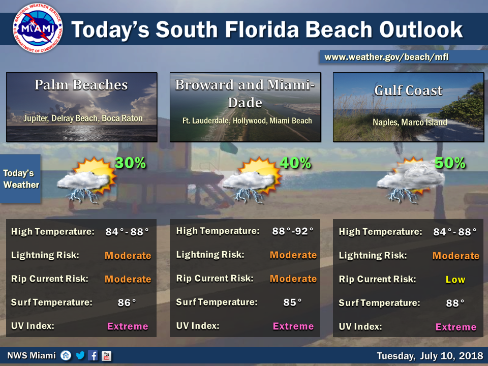
 South Florida will be back to afternoon storms and showers on Tuesday as we continue to keep an eye on Beryl’s remnants. Here at home, Tuesday starts with a mix of sun and clouds. Then we’ll see some storms and showers develop around midday as the sea breezes kick in. Periods of heavy rain are possible in spots. A moderate risk of rip currents is in place at the Atlantic beaches. Highs on Tuesday will be in the low 90s.
Wednesday will be another day of afternoon showers and storms. Wednesday’s highs will be in the low 90s.
Thursday will see additional moisture seep into the area as the remnants of Beryl move to our east, so periods of showers and storms are in the forecast. Thursday’s highs will be in the low 90s.
Showers and storms will be around once again on Friday, but we’ll also see some periods of sun. Friday’s highs will be in the low 90s.
Look for a summertime Saturday, with a mix of sun and clouds followed by afternoon showers and storms in spots. Highs on Saturday will be in the low 90s.
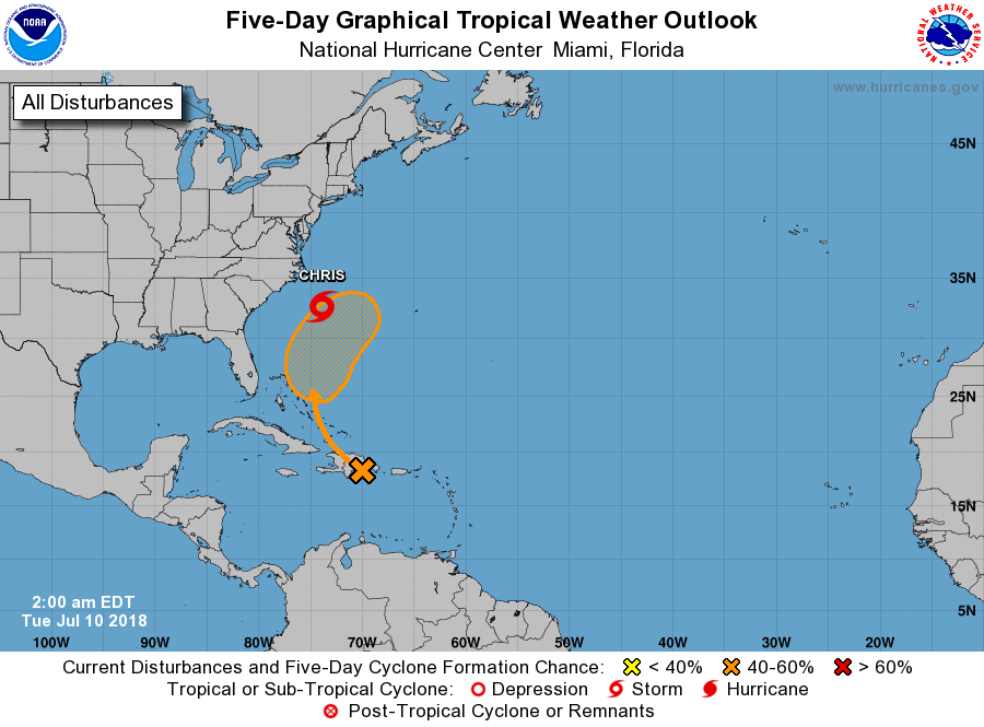 In the tropics, we’re watching what’s left of Beryl as it brings heavy rain to Hispaniola on Tuesday. Beryl’s remnants will move into the southern Bahamas, and the system has a medium chance of redeveloping into a tropical depression during the next few days. Any effects on South Florida are expected to be indirect — allowing tropical moisture to move into our area.
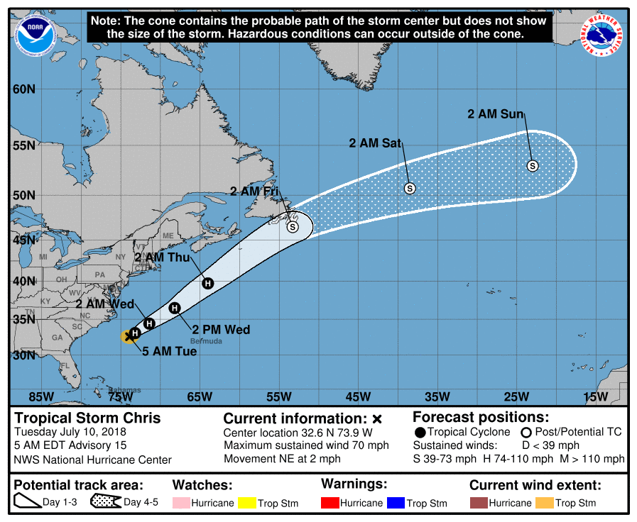 Elsewhere, Tropical Storm Chris is nearly at hurricane strength as it finally begins to move. At 5 am Tuesday, Chris was located near 32.6 North, 73.9 West, and was moving northeast at 2 miles per hour. Maximum sustained winds were up to 70 miles per hour. The impacts from Chris to the U.S. coast continue to be rough surf and an elevated risk of rip currents. Chris will pass near or over Newfoundland as an extratropical system on Friday.


