


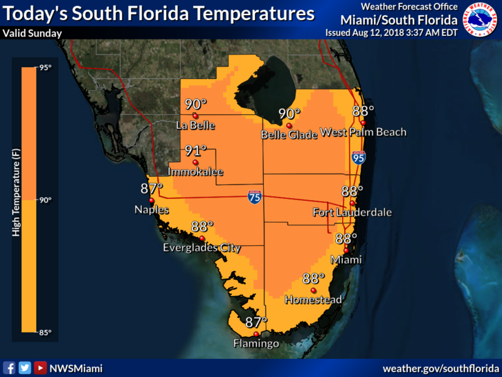
 South Florida will see early sun and afternoon storms again on Sunday. The day starts off nice, but storms and showers will form along the sea breezes after midday, with greatest activity in northern parts of our area. As for the beaches, red tide continues to plague the Gulf coast. Highs on Sunday will be near 90 degrees right at the coasts and the low 90s elsewhere — but it will feel hotter.
Monday will bring sun and clouds to start, with showers and storms in the afternoon once again. Some of those storms — especially in western parts of the area — could be strong, with heavy rains, gusty winds, and possibly small hail. Monday’s highs will be in the low 90s.
Tuesday will be another day that’s tranquil to start, with showers and storms (including some strong storms) in the afternoon hours. Tuesday’s highs will be in the low 90s.
Wednesday will see some Saharan dust work its way into South Florida, so rain chances in the eastern metro areas will decrease. Wednesday’s highs will be in the low 90s.
Look for the influence of the dust on Thursday — hazy skies, hot sun, and the chance of a late-day storm, especially well inland. Highs on Thursday will be in the low 90s.
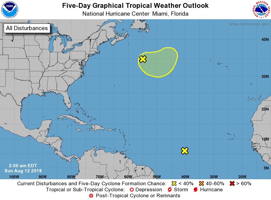 In the tropics, the area of disorganized showers halfway between the African coast and the Lesser Antilles is not expected to develop. A non-tropical low has formed in the north-central Atlantic, and it has a low chance of becoming a tropical or subtropical depression during the next several days.


