Home Weather A Warm Start To The New Year

A Warm Start To The New Year

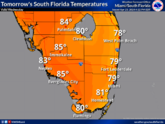
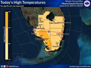
It’s a warm start to 2019 in South Florida on Tuesday.  After some early fog in spots, New Year’s Day features a mix of sun and clouds, with a few isolated showers, especially in the east coast metro area.  Highs on Tuesday will be in the low 80s.

Wednesday will bring a mix of sun and clouds, with maybe a stray shower.  Wednesday’s highs will be in the low 80s.

Look for some passing showers on Wednesday night into Thursday.  But don’t count out the sun.  Thursday’s highs will be in the low 80s.

Sun, clouds, and passing showers on a building breeze are in the forecast for Friday as a weak front moves in.  We’ll also see an increasing risk of dangerous rip currents at the Atlantic beaches.  Friday’s highs will be mostly in the low 80s.

Look for clouds and showers on Saturday.  Highs on Saturday will be in the upper 70s.

Donna Thomas has studied hurricanes for two decades. She holds a PhD in history when her experience with Hurricane Andrew ultimately led her to earn a degree in broadcast meteorology from Mississippi State University. Donna spent 15 years at WFOR-TV (CBS4 in Miami-Fort Lauderdale), where she worked as a weather producer with hurricane experts Bryan Norcross and David Bernard. She also produced hurricane specials and weather-related features and news coverage, as well as serving as pool TV producer at the National Hurricane Center during the 2004 and 2005 seasons. Donna also served as a researcher on NOAA's Atlantic Hurricane Database Reanalysis Project. Donna specializes in Florida's hurricane history.