

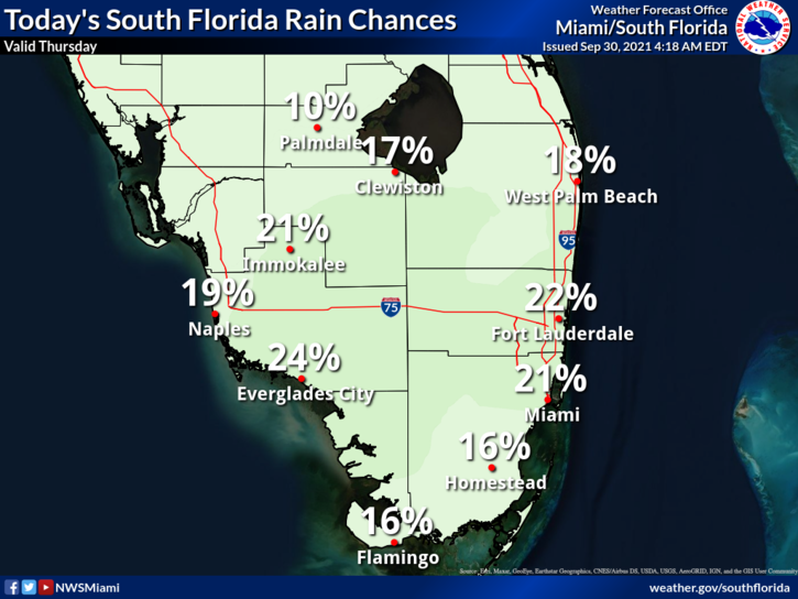
 Thursday features lots of sun with clouds and a few showers popping up in the afternoon hours. A moderate risk of dangerous rip currents remains at the Atlantic beaches on Thursday and into the weekend. Highs on Thursday will be in the upper 80s in the east coast metro area and the low 90s along the Gulf coast.
LIVE RADAR 24/7 (Click Here Then Press Play)
Friday will bring sunny skies in the morning and some showers moving through in the afternoon. Friday’s highs will be in the upper 80s in the east coast metro area and the low 90s along the Gulf coast.
Saturday will be sunny and breezy, with some showers and a stray storm during the mid to late afternoon. Saturday’s highs will be in the upper 80s in the east coast metro area and near 90 degrees along the Gulf coast.

Sunday will feature lots of sun in the morning, a brisk ocean breeze, and some showers in the afternoon. Sunday’s highs will be in the upper 80s.
Monday’s forecast calls for a mix of sun, showers, and storms in spots. Highs on Monday will be in the upper 80s.
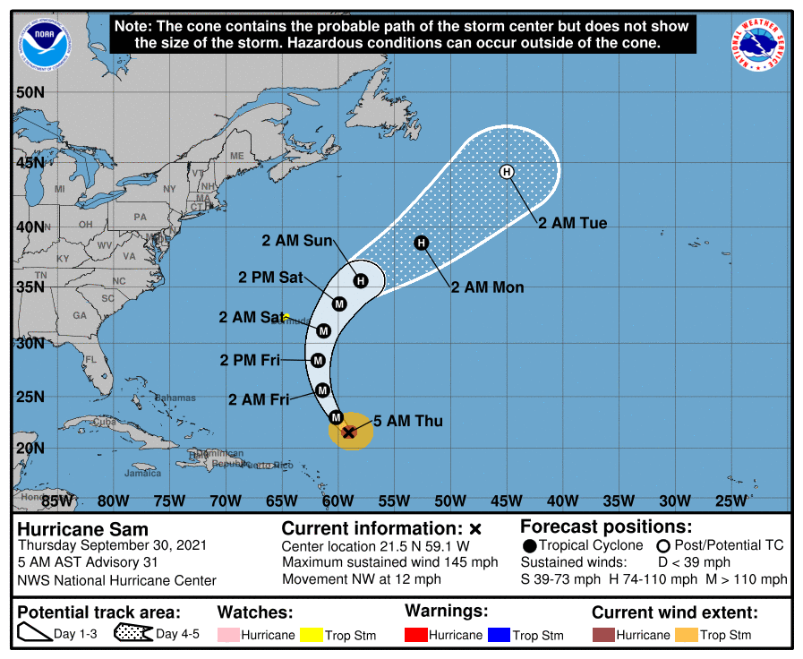 In the tropics, powerful Hurricane Sam continues its slow motion to the northwest, and a tropical storm watch is now in effect for Bermuda. At 5 am, Sam was located near 21.5 North, 59.1 West, about 825 miles south-souteast of Bermuda. Maximum sustained winds were 145 miles per hour, and Sam was moving northwest at 12 miles per hour. .
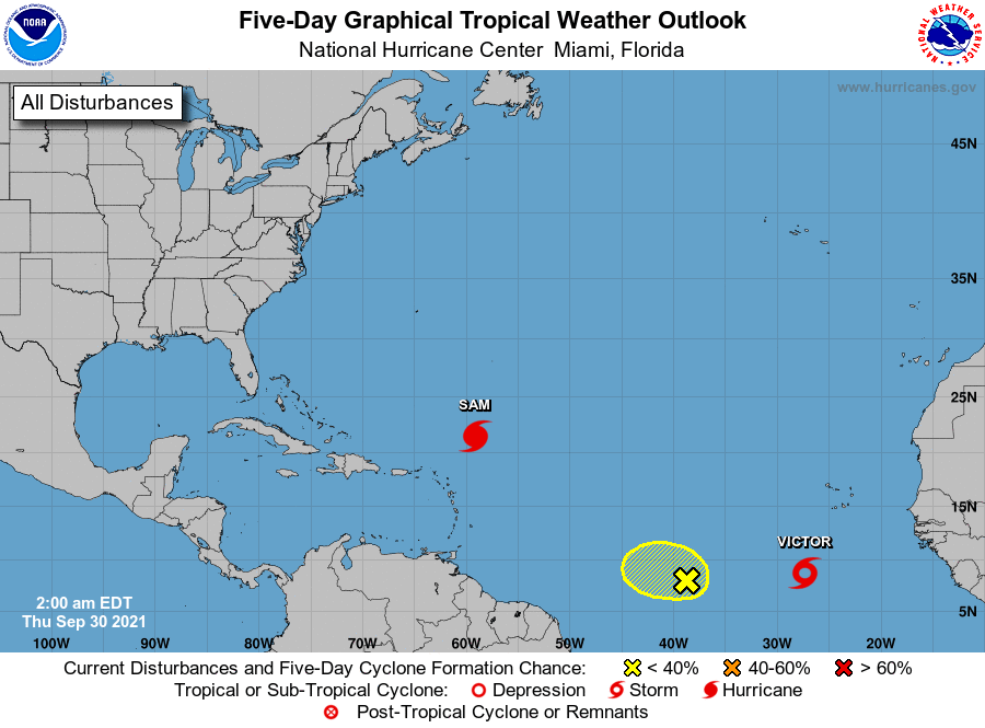 We now have Tropical Storm Victor in the eastern Atlantic. At 5 am, Victor was located near 8.7 North, 27.3 West, about 550 miles south-southwest of the Cape Verde Islands. Maximum sustained winds were 45 miles per hour, and Victor was moving west-northwest at 13 miles per hour. Victor is expected to turn to the northwest and remain in the open Atlantic.
Elsewhere, the wave entering the central Atlantic has a low chance of developing as it is likely to be affected by Tropical Storm Victor.
Disclaimer
Artificial Intelligence Disclosure & Legal Disclaimer
AI Content Policy.
To provide our readers with timely and comprehensive coverage, South Florida Reporter uses artificial intelligence (AI) to assist in producing certain articles and visual content.
Articles: AI may be used to assist in research, structural drafting, or data analysis. All AI-assisted text is reviewed and edited by our team to ensure accuracy and adherence to our editorial standards.
Images: Any imagery generated or significantly altered by AI is clearly marked with a disclaimer or watermark to distinguish it from traditional photography or editorial illustrations.
General Disclaimer
The information contained in South Florida Reporter is for general information purposes only.
South Florida Reporter assumes no responsibility for errors or omissions in the contents of the Service. In no event shall South Florida Reporter be liable for any special, direct, indirect, consequential, or incidental damages or any damages whatsoever, whether in an action of contract, negligence or other tort, arising out of or in connection with the use of the Service or the contents of the Service.
The Company reserves the right to make additions, deletions, or modifications to the contents of the Service at any time without prior notice. The Company does not warrant that the Service is free of viruses or other harmful components.


")
")
