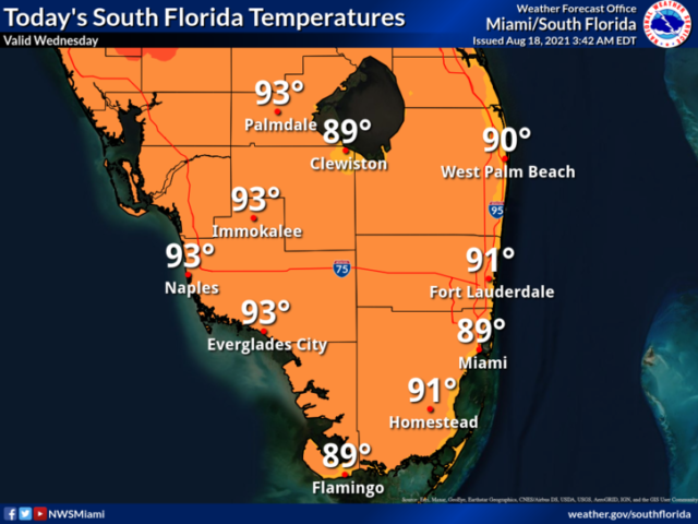
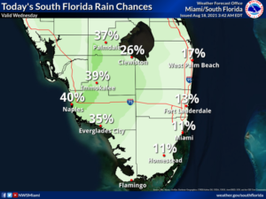
 Wednesday features plenty of sun and some mostly Gulf coast afternoon showers and storms. A moderate risk of dangerous rip currents remains at the Atlantic beaches. Highs on Wednesday will be in the sticky low 90s.
LIVE RADAR 24/7 (Click Here Then Press Play)
Thursday will be another day with lots of morning sun and a few showers and storms developing in the mid to late afternoon. Thursday’s highs will be in the humid low 90s.
Friday will keep the trend going, with sunny skies most of the day and some showers and storms after the middle of the afternoon. Friday’s highs will be in the low 90s.
Saturday will feature lots of sun and passing showers and storms in the afternoon. Saturday’s high will be in the low 90s.
Sunday’s forecast calls for mostly sunny skies and some showers and storms in spots. Highs on Sunday will be in the low 90s again.
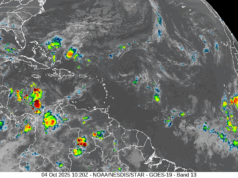
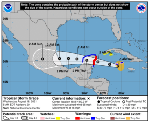 Tropical Storm Grace was approaching the Cayman Islands early on Wednesday. At 5 am, Grace was located about 40 miles south-southeast of Grand Cayman. Maximum sustained winds were 65 miles per hour, and Grace was moving west at 16 miles per hour. A tropical storm warning and a hurricane watch are in effect for the Cayman Islands, and there’s a hurricane warning for portions of the Yucatan. Grace continues to dump flooding rains on portions of the Caribbean, and mudslides and flash flooding are possible, especially in Jamaica. Grace is expected to reach the Yucatan as a hurricane on Thursday, emerge into the southwestern Gulf of Mexico, and make a final landfall along the Mexican coast.
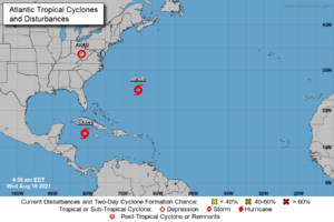 Tropical Depression Fred continues to drop very heavy rain as it transitions into a non-tropical system. At 5 am Wednesday, Fred was centered near Charleston, West Virginia, and had maximum sustained winds of 25 miles per hour.
Tropical Storm Henri is holding steady with maximum sustained winds of 65 miles per 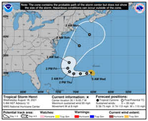 hour. At 5 am Wednesday, Henri was located near 30.1 North, 65.7 West, about 160 miles south-southwest of Bermuda. The tropical storm watch for Bermuda has been dropped. Henri was moving west at 8 miles per hour and will eventually move to the northeast and away from land.
Disclaimer
The information contained in South Florida Reporter is for general information purposes only.
The South Florida Reporter assumes no responsibility for errors or omissions in the contents of the Service.
In no event shall the South Florida Reporter be liable for any special, direct, indirect, consequential, or incidental damages or any damages whatsoever, whether in an action of contract, negligence or other tort, arising out of or in connection with the use of the Service or the contents of the Service. The Company reserves the right to make additions, deletions, or modifications to the contents of the Service at any time without prior notice.
The Company does not warrant that the Service is free of viruses or other harmful components


