Home Accuweather.com Record Ocean Heat and El Niño Are Setting the Stage for Wild...

Record Ocean Heat and El Niño Are Setting the Stage for Wild Winter Weather

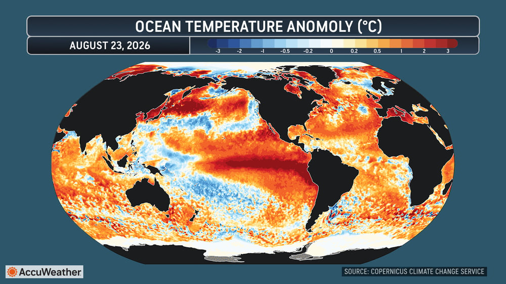
The world’s oceans have reached their highest daily average surface temperature on record, adding another factor that could influence weather across North America heading into fall and winter.

The average sea surface temperature across the world’s oceans outside the polar regions reached a record 21.1°C (70.0°F) on Aug. 22, surpassing the previous record set in March 2024.

Global ocean temperatures are typically at their warmest in March and April, yet the new record was reached in August, as a powerful El Niño develops across the tropical Pacific.

“For people across North America, the ocean temperature record itself is only part of the story,” said AccuWeather lead long-range forecaster Paul Pastelok. “What we’re watching closely is how all of this ocean warmth interacts with a strengthening El Niño. That combination can have important implications on intensity of storm track, temperatures and precipitation patterns across the continent in the months ahead.”

Faith Based Events
SST GRAPH (1)
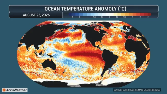
SST GLOBE MAP

What This Could Mean for North America

Warmer ocean water leads to increased evaporation and added moisture to the atmosphere, while El Niño can help alter the jet stream and guide more intense, wetter storms into different areas of North America.

The exact impacts will depend on how El Niño evolves, but AccuWeather experts are closely watching several factors:

  • Storm track: El Niño can shift the jet stream and influence where storms travel across the United States and Canada, often favoring a more active storm track across the southern U.S., from California and the Southwest to the Gulf Coast and Southeast.
  • Heavy precipitation: Warmer oceans increase the amount of moisture available to storms, potentially contributing to heavier rain and snow. California, the Southwest and southern U.S. can see increased opportunities for precipitation during a typical El Niño pattern. Also, El Nino can lead to longer stretches of cloudy weather during the colder months, especially across the southern and eastern states.
  • Temperature patterns: El Niño can favor warmer-than-historical-average conditions across parts of the northern U.S. and southern Canada, while changes in the jet stream can still allow periods of cold weather.
  • Atlantic hurricanes: Near-record-warm Atlantic waters can fuel tropical systems, but a strengthening El Niño can counteract some of that influence by increasing disruptive wind shear, making it harder for storms to develop and strengthen.

These impacts will not happen all at once or immediately. It can take time for a strengthening El Niño to reshape weather patterns across North America, and its influence can evolve over several months. Some of the most significant impacts may not emerge until later this fall or winter and could persist into next spring.

“Warm oceans don’t guarantee more storms, but they can give storms more moisture to work with,” said Pastelok. “The location and intensity of the jet stream and storm track will ultimately determine where that moisture goes and the rate that it falls. That’s why the evolution of El Niño will be so important for North America this fall and winter.”

El Niño Will Be Key Heading into Winter

El Niño develops when ocean temperatures become unusually warm across the central and eastern tropical Pacific. Because the Pacific covers such an enormous area, those changes can reshape atmospheric circulation far beyond the tropics.

For North America, El Niño’s influence typically becomes more pronounced during the colder months.

A typical El Niño winter can favor a more active southern storm track, increasing opportunities for storms and precipitation across portions of the southern United States. Parts of the northern United States and Canada can experience warmer-than-historical-average conditions.

However, no two El Niño events produce exactly the same weather pattern.

“You can’t look at El Niño and automatically predict what the winter will be like in a specific city,” Pastelok explained. “But when an El Niño becomes particularly strong, it can become one of the major forces shaping the large-scale weather pattern across North America. How strong this event becomes and where the warmest Pacific waters set up will be critical.”

If the developing El Niño continues to strengthen through the fall and winter, global sea surface temperatures could challenge the record again next spring.


Disclaimer

Artificial Intelligence Disclosure & Legal Disclaimer

AI Content Policy.

To provide our readers with timely and comprehensive coverage, South Florida Reporter uses artificial intelligence (AI) to assist in producing certain articles and visual content.

Articles: AI may be used to assist in research, structural drafting, or data analysis. All AI-assisted text is reviewed and edited by our team to ensure accuracy and adherence to our editorial standards.

Images: Any imagery generated or significantly altered by AI is clearly marked with a disclaimer or watermark to distinguish it from traditional photography or editorial illustrations.

General Disclaimer

The information contained in South Florida Reporter is for general information purposes only.

South Florida Reporter assumes no responsibility for errors or omissions in the contents of the Service. In no event shall South Florida Reporter be liable for any special, direct, indirect, consequential, or incidental damages or any damages whatsoever, whether in an action of contract, negligence or other tort, arising out of or in connection with the use of the Service or the contents of the Service.

The Company reserves the right to make additions, deletions, or modifications to the contents of the Service at any time without prior notice. The Company does not warrant that the Service is free of viruses or other harmful components.