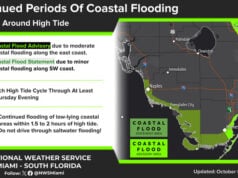
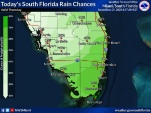
 Thursday features lots of clouds in the east coast metro area and some sun along the Gulf coast. Look for showers and storms on a gusty breeze throughout South Florida. A high risk of dangerous rip currents remains at the Atlantic beaches through at least Saturday evening. Highs on Thursday will be in the low 80s in the east coast metro area and the mid-80s along the Gulf coast.
LIVE RADAR 24/7 (Click Here Then Press Play)
Friday will be very breezy and mostly cloudy, with periods of showers and storms. Heavy downpours are possible in spots, and localized flooding is likely. Friday’s highs will be in the low 80s in the east coast metro area and the mid-80s along the Gulf coast.
Saturday will be windy and cloudy. Widespread showers and storms will move through, with periods of heavy rain and localized flooding. We’ll also be ready to take action in advance of Eta. Saturday’s highs will be near 80 degrees.
Sunday’s forecast depends on the track of Eta. For now, we’ll say the day will be windy, cloudy, and very rainy. Flooding will be possible in some locations. Sunday’s highs will be in the low 80s.
Monday’s forecast is all about Eta, which is likely to make its closest approach to us late on Monday or early on Tuesday. At this point, we can definitely say that strong winds and periods of flooding rain are possible. Highs on Monday will be in the low 80s.
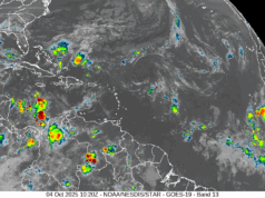
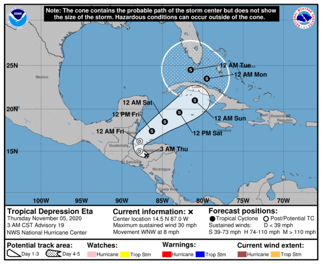
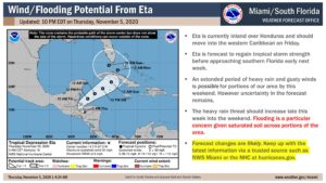 In the tropics, Eta is now a tropical depression, but it continues to bring heavy rain and dangerous flash flooding to portions of Central America. At 4 am Thursday, Eta was located near 14.5 North, 87.0 West, and was moving west-northwest at 8 miles per hour. Maximum sustained winds were 30 miles per hour. Eta is forecast to reenter the Caribbean overnight and restrengthen to a tropical storm as it moves in the direction of western Cuba.
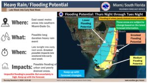 We’ll watch Eta very carefully during the next several days. At this time, South Florida is in the 4-to-5-day “cone,” and it makes sense to top off your hurricane kit if necessary. Eta is forecast to make its closest approach to us on Monday into Tuesday, and at time computer models indicate it will be a strong tropical storm. This is a more complicated forecast than usual, so make sure to keep track of Eta and be ready to act if necessary.
Disclaimer
The information contained in South Florida Reporter is for general information purposes only.
The South Florida Reporter assumes no responsibility for errors or omissions in the contents of the Service.
In no event shall the South Florida Reporter be liable for any special, direct, indirect, consequential, or incidental damages or any damages whatsoever, whether in an action of contract, negligence or other tort, arising out of or in connection with the use of the Service or the contents of the Service. The Company reserves the right to make additions, deletions, or modifications to the contents of the Service at any time without prior notice.
The Company does not warrant that the Service is free of viruses or other harmful components


