

 Tuesday will feature plenty of sun and a few clouds on a brisk breeze. A high risk of dangerous rip currents is in place along the Atlantic coast and will remain for much of the week. Highs on Tuesday will be mostly in the low 80s in the east coast metro area and the upper 80s near the Gulf coast.
LIVE RADAR 24/7 (Click Here Then Press Play)
Wednesday will feature sun, clouds, and a few showers at times along the Gulf coast, while the east coat metro area will see sun and clouds in the morning, followed by more clouds and periods of showers during the afternoon and evening. Wednesday’s highs will be in the low 80s in the east coast metro area and the mid 80s along the Gulf coast.
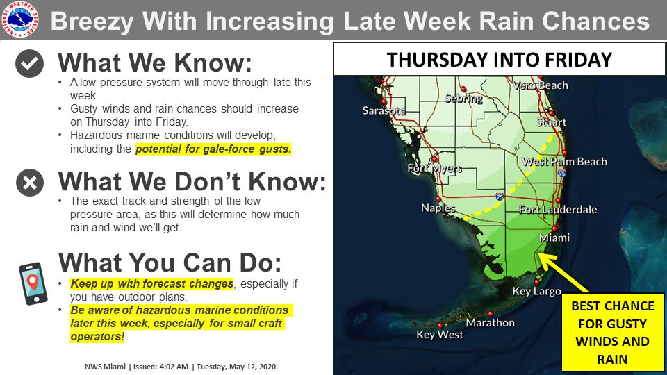 Thursday will bring clouds, showers, and breezy conditions. Thursday’s highs will be in the mid 80s along the Gulf coast and near 80 degrees in the east coast metro area.

Look for good sun, some clouds on a brisk breeze, and periods of showers on Friday. Friday’s highs will be in the low to mid 80s.
Saturday will feature a mix of sun, clouds, and passing showers. Highs on Saturday will be in the mid 80s.
Disclaimer
The information contained in South Florida Reporter is for general information purposes only.
The South Florida Reporter assumes no responsibility for errors or omissions in the contents of the Service.
In no event shall the South Florida Reporter be liable for any special, direct, indirect, consequential, or incidental damages or any damages whatsoever, whether in an action of contract, negligence or other tort, arising out of or in connection with the use of the Service or the contents of the Service. The Company reserves the right to make additions, deletions, or modifications to the contents of the Service at any time without prior notice.
The Company does not warrant that the Service is free of viruses or other harmful components


