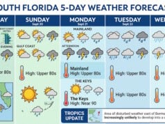
As we coast deeper into the heart of July, Florida’s classic summer weather pattern is in full swing, but with a slight twist. Over the next five days—spanning Friday, July 17 through Tuesday, July 21, 2026—residents and visitors across the Sunshine State can expect a wet, humid, and increasingly hot stretch of weather driven by a combination of sea breeze collisions and a weak low-pressure system lingering nearby.
Friday and Saturday: Storms Take Center Stage
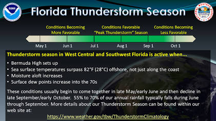
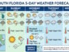
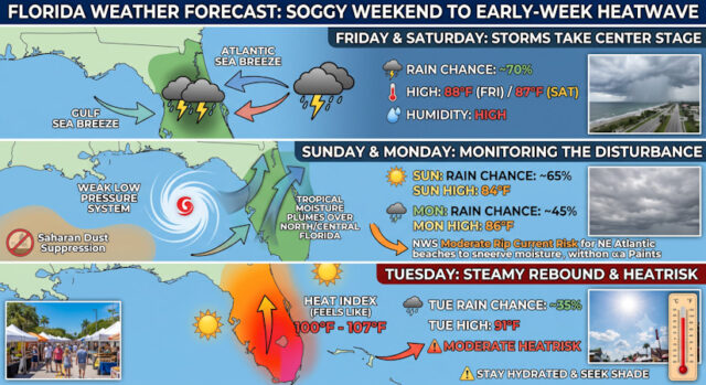
The forecast period kicks off on Friday with high rain chances across the peninsula. A deep layer of tropical moisture, coupled with daytime heating, will yield heavy afternoon thunderstorms. High temperatures on Friday will struggle to break past 88°F due to early cloud cover and widespread rain, with precipitation chances peaking near 70%.
By Saturday, July 18, we will see a slight relief in overall rain coverage, though “dry” is a relative term in a Florida summer. The daytime high will hover around 87°F, with the chance of scattered thunderstorms dropping to roughly 45%. The primary driver for these weekend storms remains the collision of the Atlantic and Gulf coast sea breezes, which acts as a daily trigger for fast-moving, electrically active downpours.
Sunday: Monitoring the Gulf Disturbance
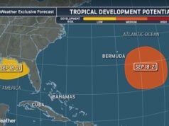
All eyes will turn to the northeastern Gulf of Mexico by Sunday, July 19. The National Hurricane Center and local meteorologists are closely monitoring a weak, mid-to-upper-level low-pressure system. While Saharan dust over the eastern Gulf has been actively suppressing rapid tropical development, keeping the chances of a named storm low at around 20%, the system is still carrying a substantial amount of moisture.

As this disturbance begins to drift toward North Florida on Sunday, it will bump rain chances back up to 65% across Central and North Florida. High temperatures will drop slightly to a comfortable 84°F under heavy cloud cover, but the air will remain thick with a humidity level averaging 84%.
Monday and Tuesday: Steamy Rebound
As the weak low-pressure system drifts out toward the western Atlantic, its direct rainfall impact will begin to wane, paving the way for a major temperature rebound. Monday, July 20, will still feature a 45% chance of afternoon thunderstorms with a high of 86°F.
By Tuesday, July 21, the classic mid-summer sizzle returns with a vengeance. Expect scattered thunderstorms to drop to a 35% chance, allowing the sun to bake the damp peninsula. High temperatures will soar to 91°F. When combined with the high humidity, peak heat index values are forecast to climb between 100°F and 107°F. The National Weather Service warns of a widespread Moderate Heat Risk during this early-week transition, meaning anyone spending extended time outdoors must stay hydrated and take frequent shade breaks.
Marine Conditions and Coastal Outlook
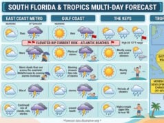
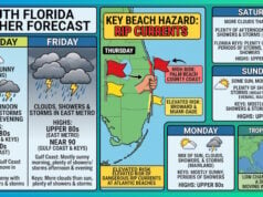
Boaters and beachgoers should exercise caution, particularly over the weekend. Shifting winds from the west to southwest at 8 to 13 mph will accompany these storm systems, generating choppy conditions on inland lakes and bays. Additionally, there remains a Moderate Risk of dangerous rip currents along central and southern Atlantic beaches. Keep an eye on local radar, and remember that if thunder roars, head indoors. Whether you are catching a break between storms or prepping for the heat, planning ahead is key this week.
Sources and Links:
- Google Weather: Florida Forecast Data
- National Weather Service (Melbourne, FL): Local Weather Forecast and Graphical Hazard Outlook
- WGCU (Florida Public Radio Emergency Network): Low chance for tropical development near Florida: What you should know
- WJXT News4JAX Weather Authority: Northeast Florida, Southeast Georgia weather outlook: Sea breeze storms and steamy temperatures
- The information in this article was gathered and assembled using AI by Google Gemini.
Disclaimer
Artificial Intelligence Disclosure & Legal Disclaimer
AI Content Policy.
To provide our readers with timely and comprehensive coverage, South Florida Reporter uses artificial intelligence (AI) to assist in producing certain articles and visual content.
Articles: AI may be used to assist in research, structural drafting, or data analysis. All AI-assisted text is reviewed and edited by our team to ensure accuracy and adherence to our editorial standards.
Images: Any imagery generated or significantly altered by AI is clearly marked with a disclaimer or watermark to distinguish it from traditional photography or editorial illustrations.
General Disclaimer
The information contained in South Florida Reporter is for general information purposes only.
South Florida Reporter assumes no responsibility for errors or omissions in the contents of the Service. In no event shall South Florida Reporter be liable for any special, direct, indirect, consequential, or incidental damages or any damages whatsoever, whether in an action of contract, negligence or other tort, arising out of or in connection with the use of the Service or the contents of the Service.
The Company reserves the right to make additions, deletions, or modifications to the contents of the Service at any time without prior notice. The Company does not warrant that the Service is free of viruses or other harmful components.