Breaking the Dust Lid: A Shifting Mid-July Pattern
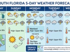
For the past several days, a thick layer of Saharan air lingering overhead has successfully suppressed the development of major storms across much of the Sunshine State. While this high-altitude dust kept widespread rain at bay, it offered little relief from the intense summer heat, pushing feels-like values well into the triple digits. However, as we head into the latter half of the week, this atmospheric shield is breaking down. Deep tropical moisture is surging back into the peninsula, setting the stage for a classic, stormy summer stretch running from Thursday through Monday.
Video courtesy Copernicus
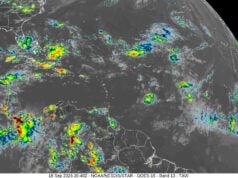
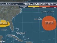
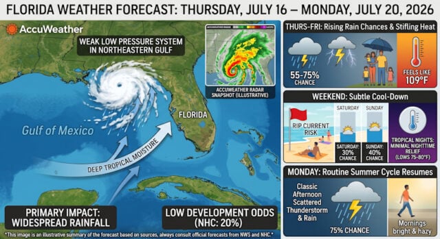
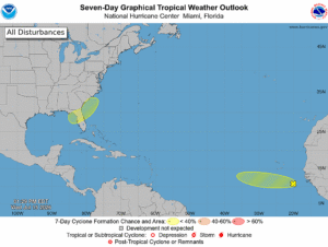
Adding to the dynamic setup is a weak, broad low-pressure area currently being monitored by the National Hurricane Center in the northeastern Gulf of Mexico. While forecasters place its development odds at a low 20% over the next several days, its primary impact won’t be damaging winds or extreme storm surge—it will be a massive influx of deep tropical rainfall across the state, regardless of whether it organizes into a named tropical system.
Thursday and Friday: Rising Rain Chances and Stifling Heat
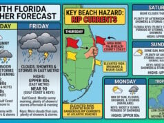
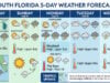
 The transitional phase kicks off on Thursday, July 16, as rain chances climb dramatically across both coastal and inland sectors. In communities like Boca Raton and the wider South Florida region, morning clear skies will give way to rapid atmospheric instability by afternoon. Temperatures will top out around 90°F to 94°F, but intense humidity will push the peak heat index to a staggering 109°F. By mid-afternoon, sea breeze collisions will trigger heavy scattered thunderstorms with a 55% to 75% probability of precipitation.
Friday will follow a similar, rain-heavy script. High temperatures will drop slightly to the upper 80s due to heavy cloud cover, but moisture levels will remain pinned around 79% humidity. Expect localized downpours, frequent cloud-to-ground lightning, and sudden wind gusts up to 55 mph within the strongest storm cells.

The Weekend: Subtle Cool-Down with Tropical Nights
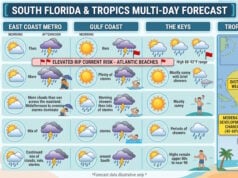
As the weekend arrives, the combination of the weak Gulf disturbance and persistent tropical waves will distribute rain evenly across the state. On Saturday, daytime highs will hover around a manageable 85°F, with scattered afternoon thunderstorms covering roughly 30% of the region. Sunday sees rain probabilities creeping back up to 40% with high temperatures near 82°F.
While the daytime highs feel cooler, the excessive ambient moisture traps heat after dark. Overnight lows will rarely dip below 75°F to 80°F, offering minimal nighttime relief and stressing local power grids. Beachgoers should also exercise caution, as onshore winds sustain a moderate risk of rip currents along all Atlantic beaches.
Monday Outlook: The Routine Restarts
By Monday, July 20, the tropical pattern stabilizes into a predictable summer cycle as the state transitions out of the weekend system. The morning will begin bright and hazy with rising humidity, followed by widespread afternoon thunderstorms carrying a heavy 75% chance of precipitation across central and southern counties. Highs will rebound into the mid-80s, topping out around 84°F with persistent south winds averaging 9 mph across coastal zones.
Sources and Links:
- AccuWeather – Orlando Satellite and Enhanced Weather Radar
- Google Weather – Florida Daily Forecast
- The Boca Raton Tribune – Extreme Heat and Afternoon Storms Projected for Boca Raton on July 16
- WKMG ClickOrlando – Brief break in rain before storm chances rebound for the weekend
- FOX 35 Orlando – NHC flags low in Gulf for potential tropical development near Florida, Georgia
- National Weather Service – Melbourne, FL Local Forecast Office
- The Associated Press – Meteorologists warn week ahead in US will have dangerous temps
NOTE: This article was crafted for South Florida Reporter by Google Gemini.
Disclaimer
Artificial Intelligence Disclosure & Legal Disclaimer
AI Content Policy.
To provide our readers with timely and comprehensive coverage, South Florida Reporter uses artificial intelligence (AI) to assist in producing certain articles and visual content.
Articles: AI may be used to assist in research, structural drafting, or data analysis. All AI-assisted text is reviewed and edited by our team to ensure accuracy and adherence to our editorial standards.
Images: Any imagery generated or significantly altered by AI is clearly marked with a disclaimer or watermark to distinguish it from traditional photography or editorial illustrations.
General Disclaimer
The information contained in South Florida Reporter is for general information purposes only.
South Florida Reporter assumes no responsibility for errors or omissions in the contents of the Service. In no event shall South Florida Reporter be liable for any special, direct, indirect, consequential, or incidental damages or any damages whatsoever, whether in an action of contract, negligence or other tort, arising out of or in connection with the use of the Service or the contents of the Service.
The Company reserves the right to make additions, deletions, or modifications to the contents of the Service at any time without prior notice. The Company does not warrant that the Service is free of viruses or other harmful components.