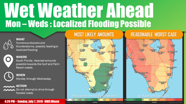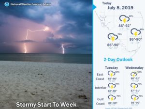
(UPDATED 5:30AM)  South Florida will see summertime rain on Monday as we watch the tropics for potential activity later in the week. In the meantime, Monday features plenty of clouds and periods of showers, with some storms thrown in along the east coast. Highs on Monday will be mostly in the upper 80s.
Tuesday will be rainy and mostly cloudy as well, with a passing storm not out of the question. Tuesday‘s highs will be in the upper 80s.
Wednesday will feature lots of clouds and periods of showers, with greatest coverage along the Gulf coast and in the interior. Wednesday‘s highs will be near 90 degrees.
We’ll see how any tropical development well to our north could affect South Florida’s weather on Thursday and beyond, but for now, we’ll say Thursday will continue the trend of mostly cloudy skies and periods of showers. Thursday’s highs will be mostly in the low 90s.
Friday’s forecast (for now) is for a mix of sun, clouds, and showers for the east coast metro area, while clouds and showers continue to dominate the Gulf coast and the interior. Highs on Friday will be in the low 90s.
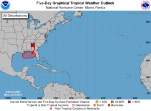
 While there’s no tropical development right now, computer models continue to indicate that a low is likely to form in the northeastern Gulf of Mexico by late in the workweek. The National Hurricane Center is giving this potential feature a high chance of developing into a tropical depression. Because this feature is likely to hover near the Florida panhandle, we’ll watch this scenario closely in the days ahead.
Disclaimer
The information contained in South Florida Reporter is for general information purposes only.
The South Florida Reporter assumes no responsibility for errors or omissions in the contents of the Service.
In no event shall the South Florida Reporter be liable for any special, direct, indirect, consequential, or incidental damages or any damages whatsoever, whether in an action of contract, negligence or other tort, arising out of or in connection with the use of the Service or the contents of the Service. The Company reserves the right to make additions, deletions, or modifications to the contents of the Service at any time without prior notice.
The Company does not warrant that the Service is free of viruses or other harmful components


