

Sunday features more clouds than sun and plenty of showers and storms, especially in the afternoon and evening. Heavy rain is possible in spots. Highs on Sunday will be in the upper 80s right at the coasts and in the Keys, while the rest of South Florida will reach the low 90s.
Monday will bring morning sun, clouds, and showers to the east coast metro area, followed by plenty of storms in the afternoon and evening. The Gulf coast will see sun and storms in the morning and lots of showers and storms in the afternoon and evening. Look for clouds, showers, and storms in the Keys. Monday’s highs will be near 90 degrees on the mainland and in the upper 80s in the Keys.
Tuesday will feature clouds, showers, and storms around South Florida. Tuesday’s highs will be near 90 degrees on the mainland and in the upper 80s in the Keys.
Wednesday will see a mix of sun and clouds on the mainland in the morning, but plenty of showers and storms will develop in the afternoon and linger into the evening. The Keys will see clouds, showers, and storms again. Wednesday’s highs will be in the low 90s on the mainland and the upper 80s in the Keys.

Thursday’s forecast calls for clouds, showers, and storms. Highs on Thursday will be in the low 90s on the mainland and the upper 80s in the Keys.

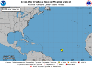 In the tropics, the wave that’s slowly moving westward in the eastern Atlantic appears to be running out of steam. The National Hurricane Center gives it a low chance of becoming a depression as it approaches the Lesser Antilles later this week. After that, conditions in the eastern Caribbean are unfavorable for development. But we’ll continue to keep an eye on it and the tropical Atlantic in general as we near the statistical peak of the hurricane season.
Disclaimer
Artificial Intelligence Disclosure & Legal Disclaimer
AI Content Policy.
To provide our readers with timely and comprehensive coverage, South Florida Reporter uses artificial intelligence (AI) to assist in producing certain articles and visual content.
Articles: AI may be used to assist in research, structural drafting, or data analysis. All AI-assisted text is reviewed and edited by our team to ensure accuracy and adherence to our editorial standards.
Images: Any imagery generated or significantly altered by AI is clearly marked with a disclaimer or watermark to distinguish it from traditional photography or editorial illustrations.
General Disclaimer
The information contained in South Florida Reporter is for general information purposes only.
South Florida Reporter assumes no responsibility for errors or omissions in the contents of the Service. In no event shall South Florida Reporter be liable for any special, direct, indirect, consequential, or incidental damages or any damages whatsoever, whether in an action of contract, negligence or other tort, arising out of or in connection with the use of the Service or the contents of the Service.
The Company reserves the right to make additions, deletions, or modifications to the contents of the Service at any time without prior notice. The Company does not warrant that the Service is free of viruses or other harmful components.


