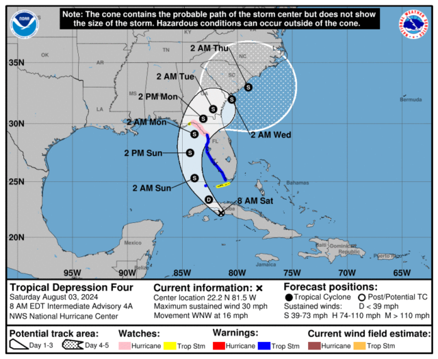
 That area of disturbed weather we’ve been watching all week is now official Tropical Depression # 4. At 5 am Saturday, TD # 4 was over Cuba and about 195 miles south-southeast of Key West. Maximum sustained winds were 30 miles per hour, and TD # 4 was moving west-northwest at 16 miles per hour.
Potential Tropical Depression # 4 formed over Cuba late Friday morning, and it’s expected to become Tropical Storm Debby in the southeastern Gulf of Mexico sometime on Saturday. As of late afternoon on Friday, there’s a tropical storm warning from Cape Sable to Boca Grande. This system will affect the weekend weather throughout South Florida and most of the state.
More of the weather forecast is below the graphic
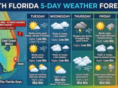
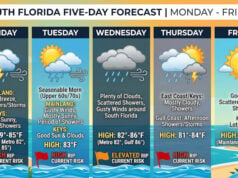
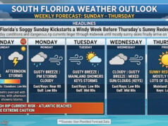
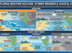
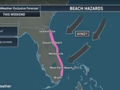
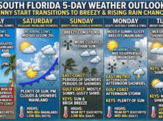
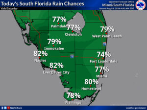
Saturday features breezy conditions, plenty of daytime showers, and evening storms as South Florida sees the closest approach to Potential TD # 4. Heavy rain and localized flooding are possible. Look for some coastal flooding along the Gulf Coast and in the Keys, and expect an increasing risk of dangerous rip currents at the Gulf beaches. Highs on Saturday will be mostly in the sticky upper 80s.
Sunday will still see breezy conditions and periods of showers and storms from a strengthening depression or tropical storm. Heavy rain and localized flooding are expected. Sunday’s highs will be mostly in the low 90s in the East Coast metro area and in the upper 80s along the Gulf Coast and in the Keys.
Monday will remain unsettled, with plenty of clouds, showers, and storms as tropical moisture lingers over much of Florida. Monday’s highs will be in the low 90s in the East Coast metro area and near 90 degrees along the Gulf Coast and in the Keys.
Tuesday will feature a mix of sun and clouds in the morning and mainly afternoon and early evening showers and storms. Tuesday’s highs will be in the low 90s.
Wednesday’s forecast calls for an August mix of hot sun, showers, and storms on the mainland. Look for clouds and showers in the Keys. Highs on Wednesday will be in the low 90s right at the coasts and in the Keys and in the mid-90s elsewhere in South Florida.
The big story in the tropics is the disturbance that became Potential Tropical Depression # 4 on Friday. At 5 pm on Friday, Potential TD # 4 was over central Cuba and about 315 miles southeast of Key West. At that time, Potential TD # 4 was moving west-northwest at 16 miles per hour and had maximum sustained winds of 30 miles per hour. Strengthening is expected after the system enters the Gulf of Mexico on Saturday morning, and we could see a tropical storm by the evening. The forecast track shows this system moving off the Florida Gulf coast on Saturday and Sunday, coming ashore on Sunday evening, most likely between the Tampa Bay area and the eastern part of the Florida panhandle. Once it tracks across northern Florida, the system is forecast to skirt the coasts of Georgia and the Carolinas early next week.
There is a tropical storm warning for the Florida Gulf coast from Cape Sable to Boca Grande as of 5 pm on Friday. At that time, there was a tropical storm watch in the Keys from Card Sound to the Dry Tortugas and on the Gulf coast from Boca Grande northward to the Suwannee River. Watch and warning areas are likely to be extended.
In South Florida, we can expect heavy and potentially flooding rain and gusty winds this weekend. If your home is in a low-lying area, prepare for possible flooding. Be sure to secure lawn furniture and other items that could be lifted up in a strong wind gust. There is no indication at this time that we will need to put up shutters. Don’t attempt to drive in flooded areas and avoid walking in flood waters.
Disclaimer
Artificial Intelligence Disclosure & Legal Disclaimer
AI Content Policy.
To provide our readers with timely and comprehensive coverage, South Florida Reporter uses artificial intelligence (AI) to assist in producing certain articles and visual content.
Articles: AI may be used to assist in research, structural drafting, or data analysis. All AI-assisted text is reviewed and edited by our team to ensure accuracy and adherence to our editorial standards.
Images: Any imagery generated or significantly altered by AI is clearly marked with a disclaimer or watermark to distinguish it from traditional photography or editorial illustrations.
General Disclaimer
The information contained in South Florida Reporter is for general information purposes only.
South Florida Reporter assumes no responsibility for errors or omissions in the contents of the Service. In no event shall South Florida Reporter be liable for any special, direct, indirect, consequential, or incidental damages or any damages whatsoever, whether in an action of contract, negligence or other tort, arising out of or in connection with the use of the Service or the contents of the Service.
The Company reserves the right to make additions, deletions, or modifications to the contents of the Service at any time without prior notice. The Company does not warrant that the Service is free of viruses or other harmful components.


