

AccuWeather® Global Weather Center – Oct. 27, 2025 – AccuWeather® hurricane experts say days of relentless rain, powerful winds, and the forecast for back-to-back landfalls from a major hurricane could bring catastrophic impacts to the western Caribbean this week.
[You can view a series of live weather cameras here. This link will also give you links to many other cameras – note weather conditions may cause camera malfuntions]
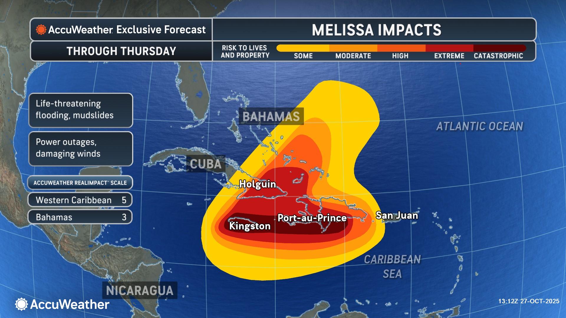
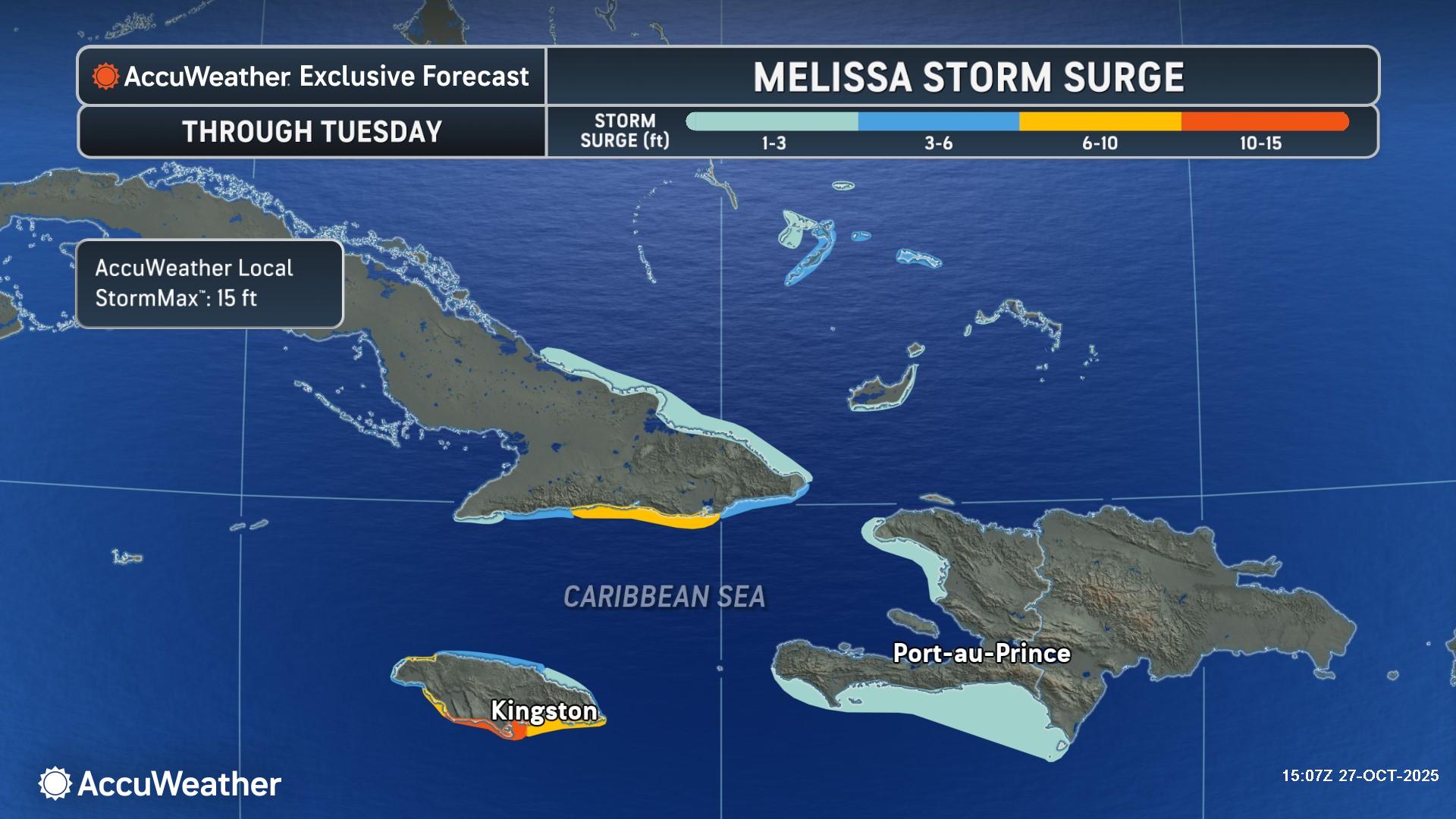
“Slow-moving major hurricanes often go down in history as some of the deadliest and most destructive storms on record. Tens of thousands of families are facing hours of extreme wind gusts above 100 mph and days of relentless, torrential rainfall,” AccuWeather® Chief Meteorologist Jonathan Porter said. “A storm surge of 10 to 15 feet in the hardest hit areas along the southern coast of Jamaica will risk lives and result in property destruction. Additionally, a storm surge of 6 to 10 feet could damage or destroy critical infrastructure along the bays and shorelines near the capital and largest city of Kingston.”

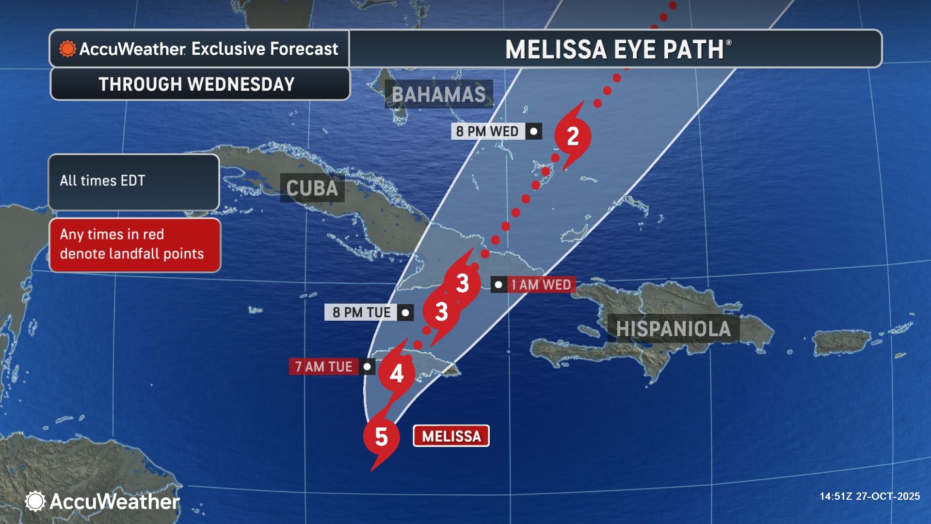
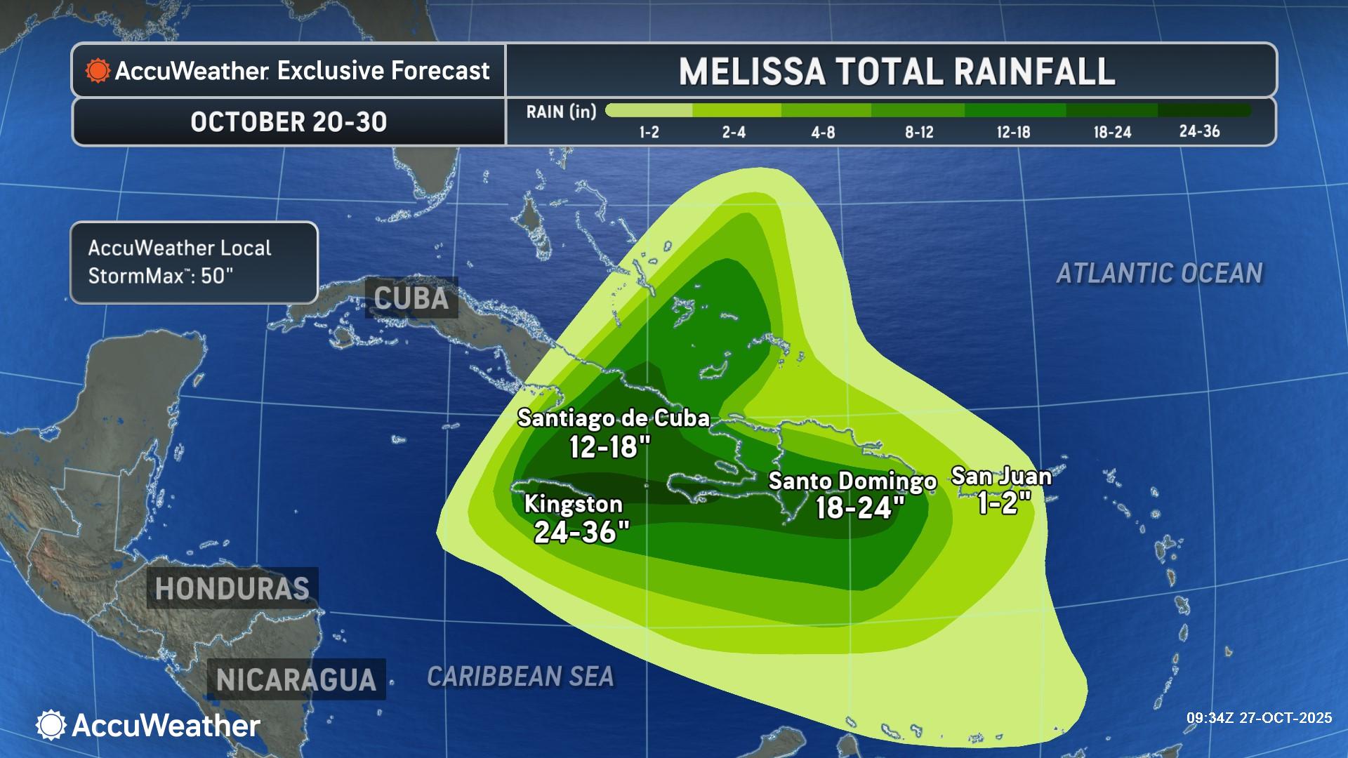
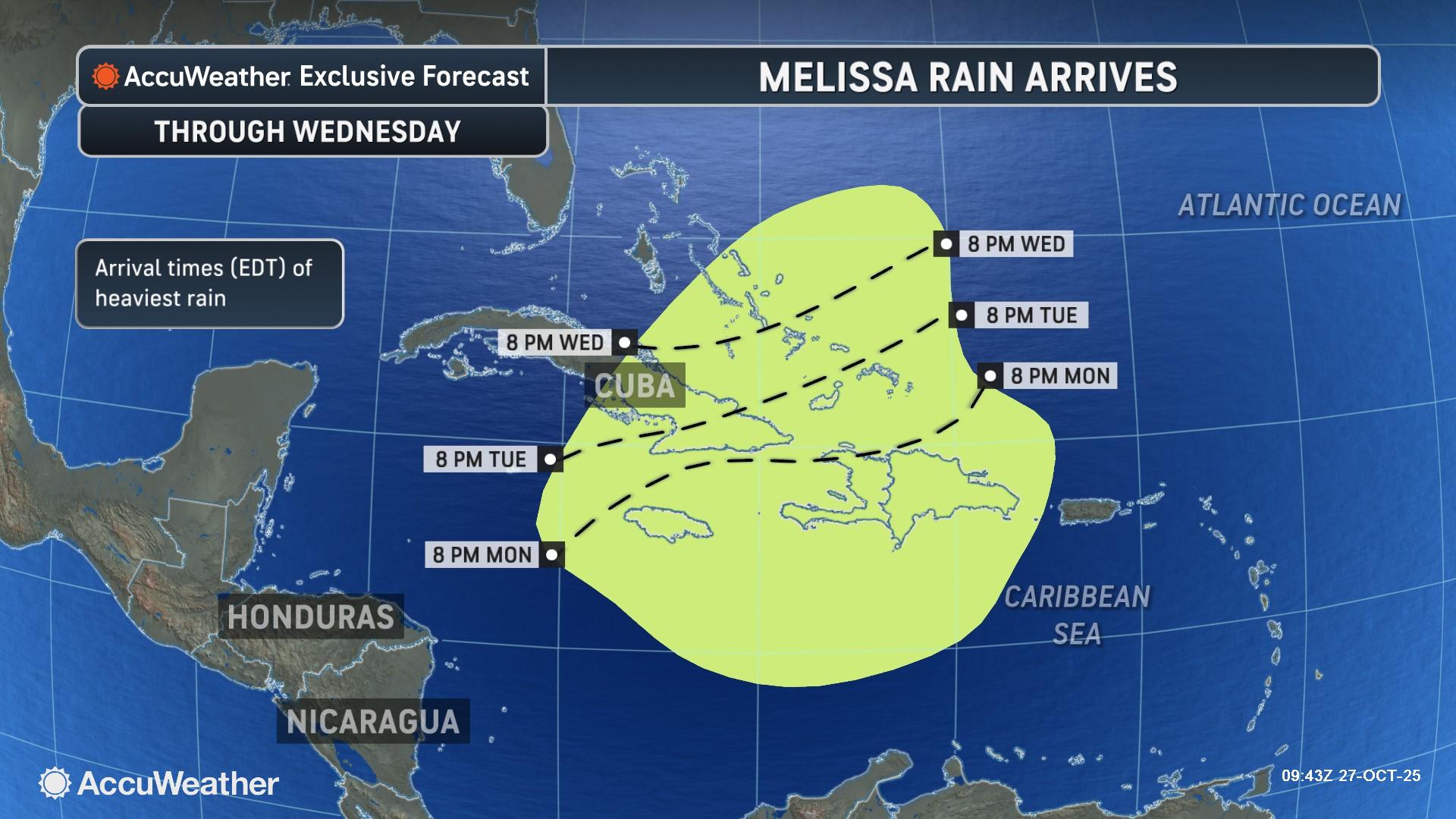
Hurricane Melissa is expected to waver between a Category 5 and a high-end Category 4 until landfall in Jamaica. Parts of Jamaica are expected to receive 24-36 inches of rain from Melissa, with an AccuWeather Local StormMax™ of 50 inches, leading to catastrophic flash flooding and mudslides.
“This is a dire situation unfolding in slow motion. A major hurricane slowly crawling toward an island with powerful winds, extreme rainfall, and damaging storm surge is a perilous situation for a place like Jamaica. We are urging people to be prepared for the storm and shelter in the safest place possible,” Porter said. “The island’s beautiful mountains are one of the reasons that it is so dangerous when a hurricane strikes. The steep terrain dramatically increases the risk of life-threatening flash floods and mudslides. Rivers, streams and gullies may not be able to handle more than 3 feet of rain expected over the next few days.”
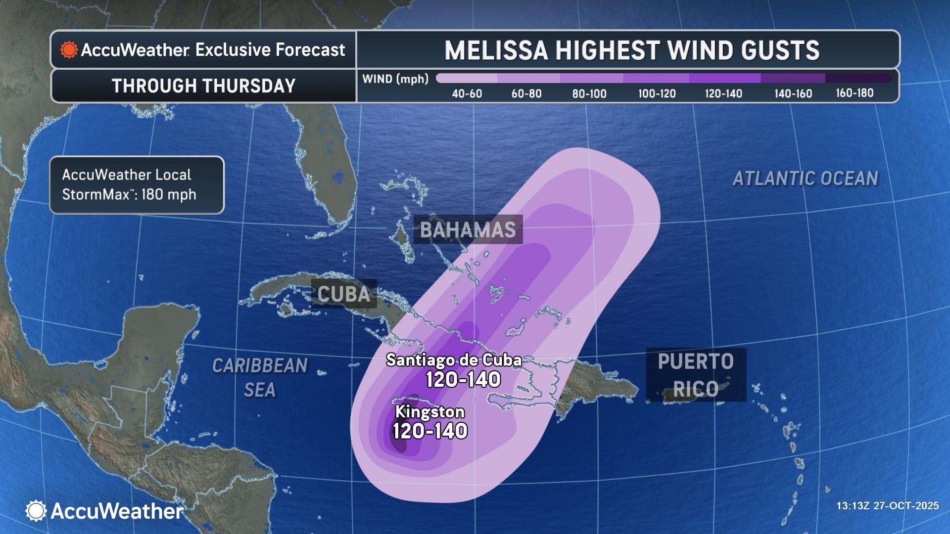
Dangerous wind gusts of 120-140 mph can occur across much of Jamaica on Monday and Tuesday. Destructive wind gusts of 160-170 mph can occur in central Jamaica near where Melissa makes landfall, with an AccuWeather Local StormMax™ of 180 mph.
A damaging storm surge of 6-10 feet is expected over southern Jamaica. Just to the east of where Melissa makes landfall in Jamaica, a destructive and life-threatening surge of 10-14 feet is expected, with an AccuWeather Local StormMax™ surge of 15 feet.
“Everyone needs to follow evacuation orders in high-risk areas. People in Jamaica have not experienced a direct strike from a major hurricane in nearly 40 years. Hurricane Gilbert made landfall in 1988 as a Category 3 storm. Gilbert was weaker and was moving faster, compared to the forecast for Melissa’s landfall in southern Jamaica,” Porter said. “Extreme impacts could last for hours in places in the path of the eyewall as the hurricane crosses the island. People need to be prepared to hunker down for days. Some vulnerable communities across the western Caribbean could be cut off and left in the dark for weeks. Widespread damage and catastrophic impacts are possible, regardless of whether Melissa makes landfall as a Category 4 or Category 5 hurricane.”
Impacts expected in Hispaniola, Cuba and Bermuda
AccuWeather® hurricane experts say Hispaniola faces an ongoing threat of widespread heavy rainfall and gusty winds as Melissa continues to slowly crawl through the Caribbean.
Melissa’s slow movement over the mountainous islands greatly increases the risk of catastrophic flash flooding and deadly mudslides. This can quickly escalate into a humanitarian crisis, where a large number of people are in need of basic supplies such as food, safe drinking water, housing and medical care.
“Parts of Haiti and the Dominican Republic have dealt with days of rain and flooding. Melissa will continue to bring more torrential rain to Hispaniola, increasing the risk of catastrophic flooding and mudslides for days to come,” Porter warned. “People in southern Cuba need to prepare for a direct hit from a major hurricane landfall.”
AccuWeather® hurricane experts say Melissa is forecast to make a second landfall in southern Cuba late Tuesday night or early Wednesday morning as a major hurricane.
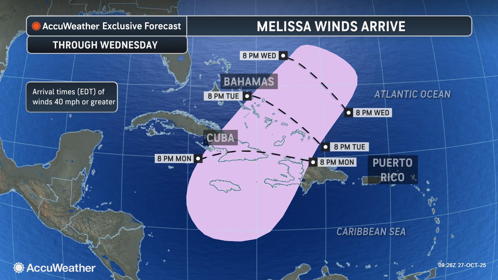
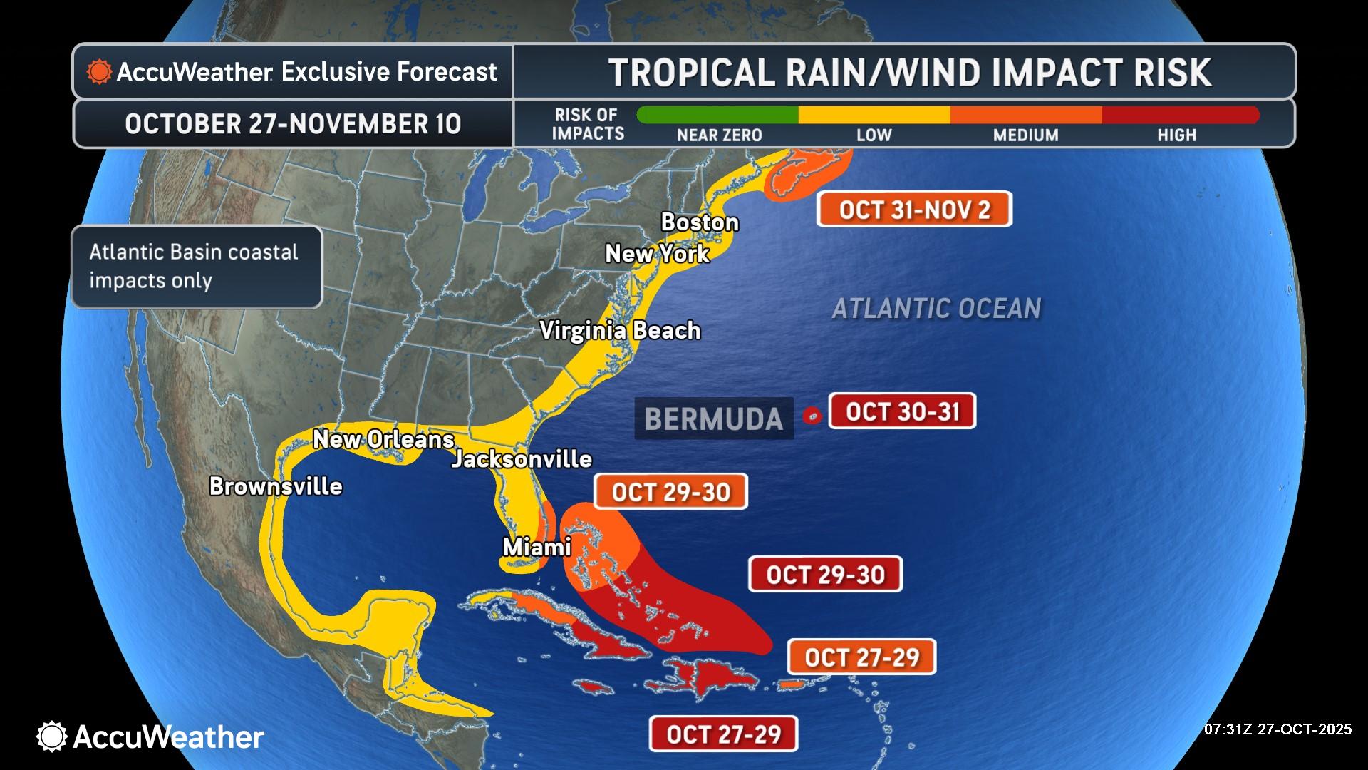
A widespread 12-18 inches of rain is expected across eastern Cuba. Wind gusts of 120-140 mph will be possible where the storm will make a second landfall in eastern Cuba. A damaging storm surge of 6-10 feet is expected for portions of the southeastern Cuba coastline.
Melissa is then forecast to pass through the Bahamas as a hurricane Tuesday night into Wednesday. It will also bring wind and rain impacts to Bermuda later Thursday as the storm moves nearby.
Melissa is rated a 5 for the western Caribbean and a 3 for the Bahamas on the AccuWeather Reallmpact™ Scale for Hurricanes.
Eye on the US East Coast and Atlantic Canada
Some coastal flooding, rough surf, and beach erosion are possible this week along the U.S. East Coast, especially if Melissa expands in size.
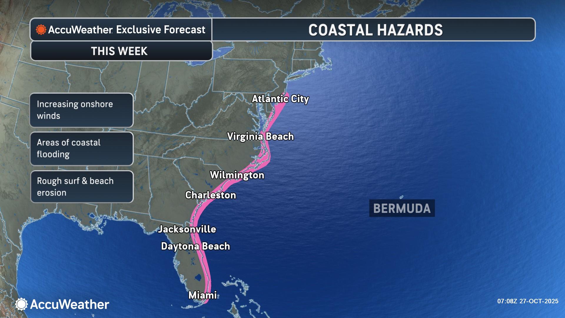
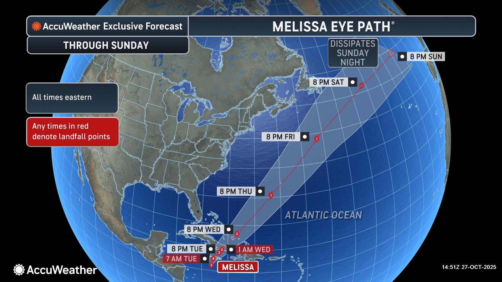
Melissa’s interaction with a dip in the jet stream over the East Coast will determine the storm’s future path. AccuWeather® hurricane experts say people along the East Coast and Atlantic Canada should monitor forecast updates closely this week, although it remains most likely that Melissa’s direct rain and wind impacts will stay offshore, but they could impact parts of Atlantic Canada this weekend.
Disclaimer
The information contained in South Florida Reporter is for general information purposes only.
The South Florida Reporter assumes no responsibility for errors or omissions in the contents of the Service.
In no event shall the South Florida Reporter be liable for any special, direct, indirect, consequential, or incidental damages or any damages whatsoever, whether in an action of contract, negligence or other tort, arising out of or in connection with the use of the Service or the contents of the Service. The Company reserves the right to make additions, deletions, or modifications to the contents of the Service at any time without prior notice.
The Company does not warrant that the Service is free of viruses or other harmful components


