

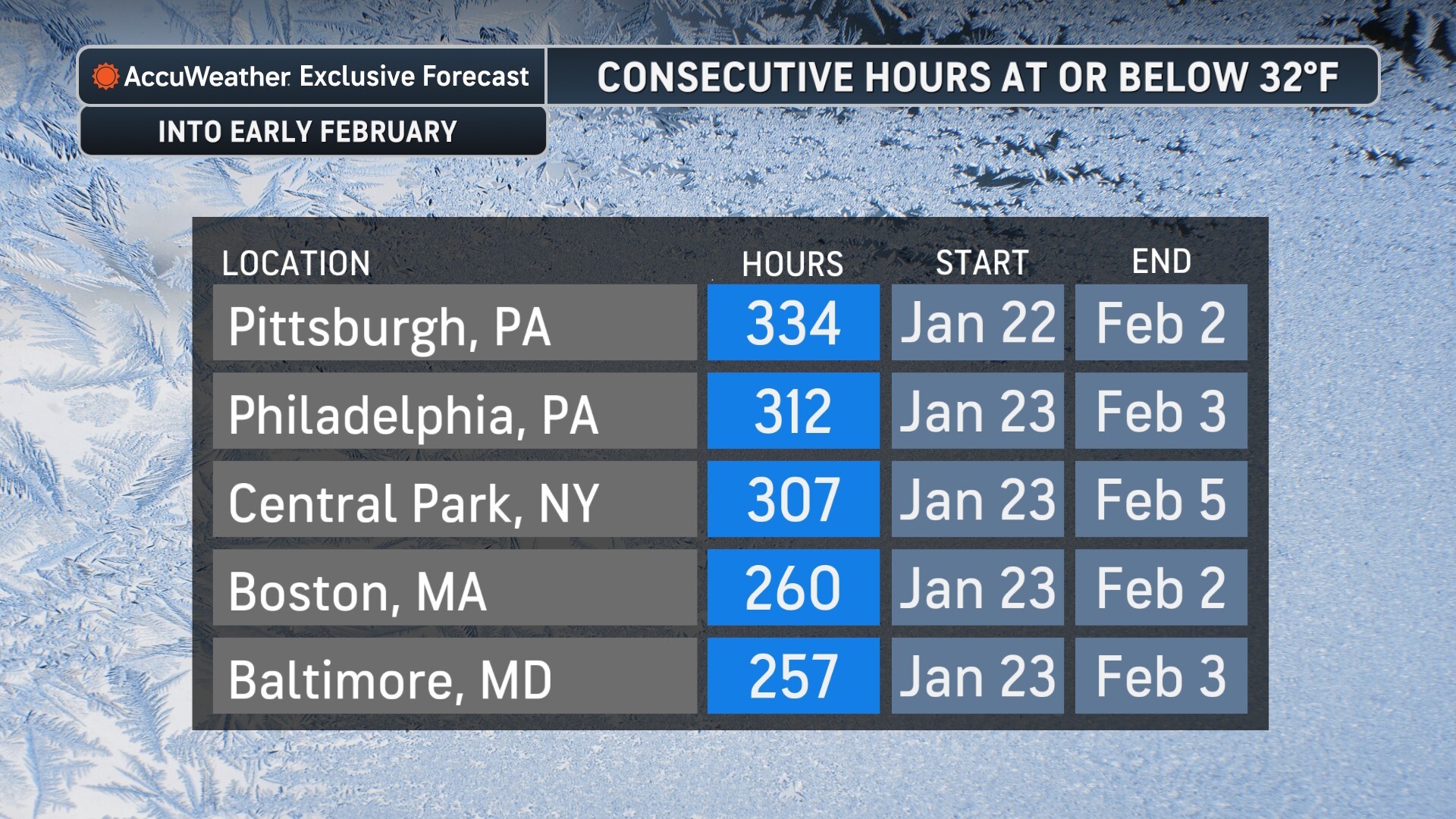
A massive and dangerous weather pattern is taking shape across the United States as an Arctic blast prepares to collide with a developing coastal system. This combination is set to trigger “bombogenesis”—a rapid drop in atmospheric pressure that creates a “bomb” cyclone—bringing the most significant winter weather event of the season. Meteorologists are warning that the upcoming window of extreme cold, paired with blizzard conditions, could be the longest duration of sub-freezing temperatures seen in several decades.
AccuWeather Forecast Images
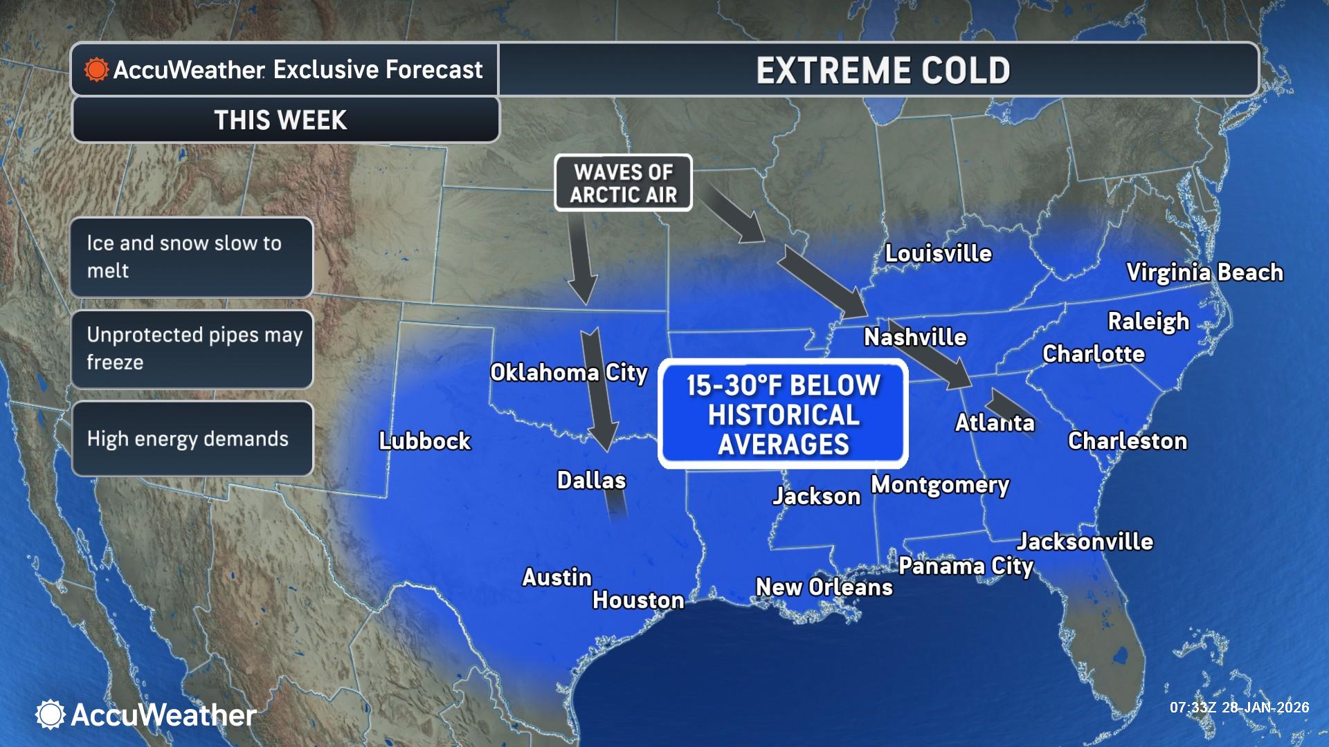
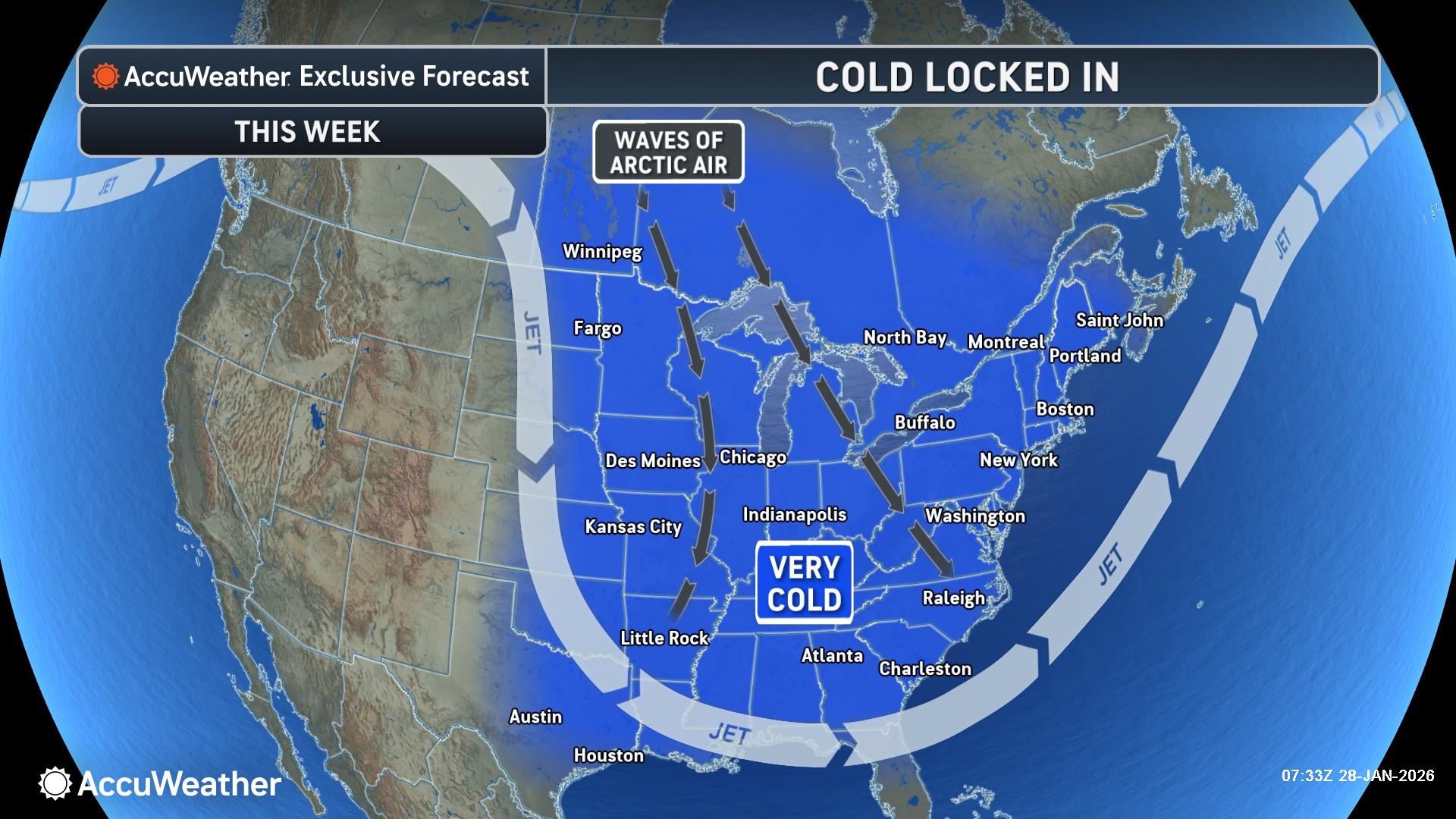
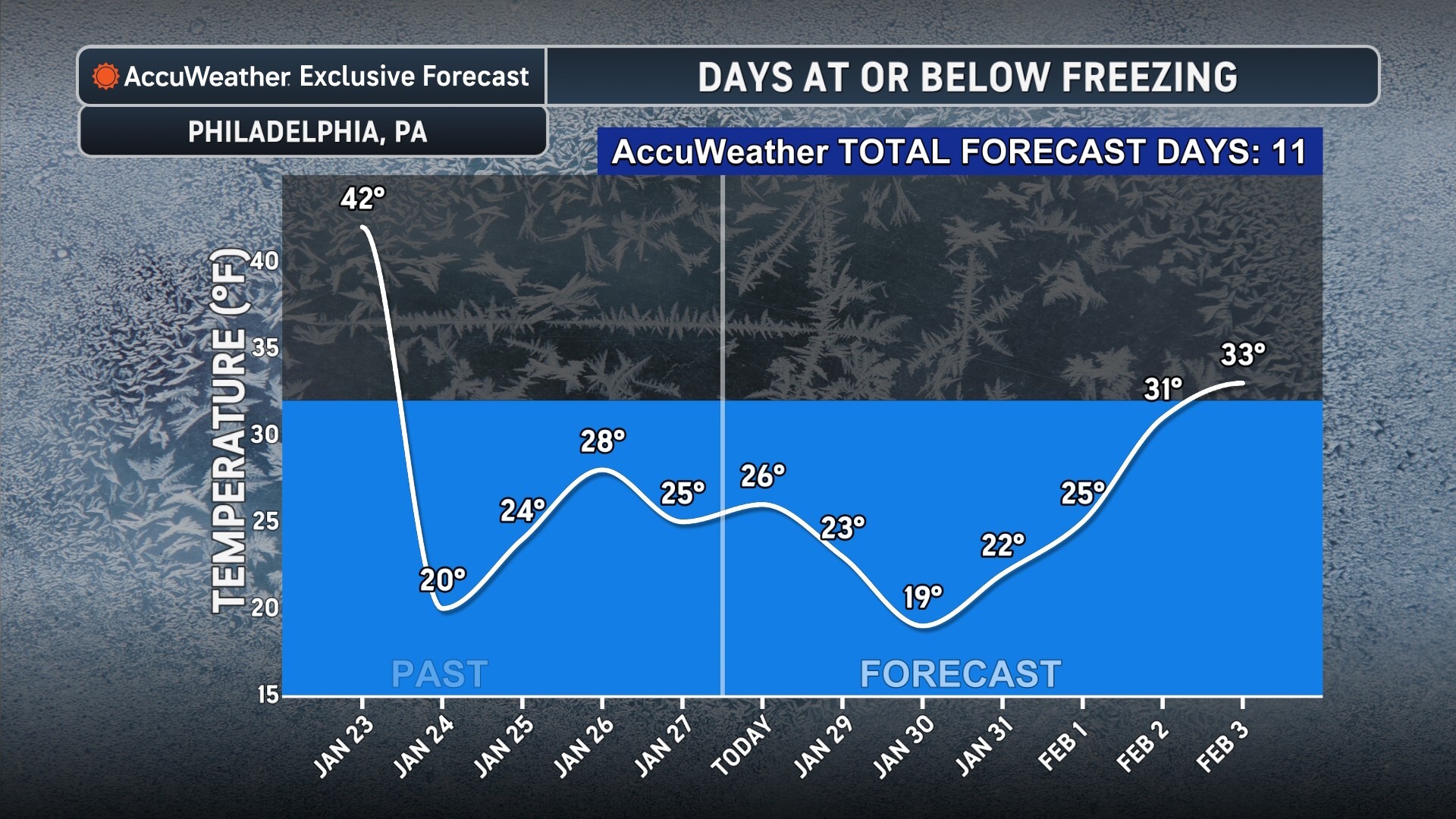
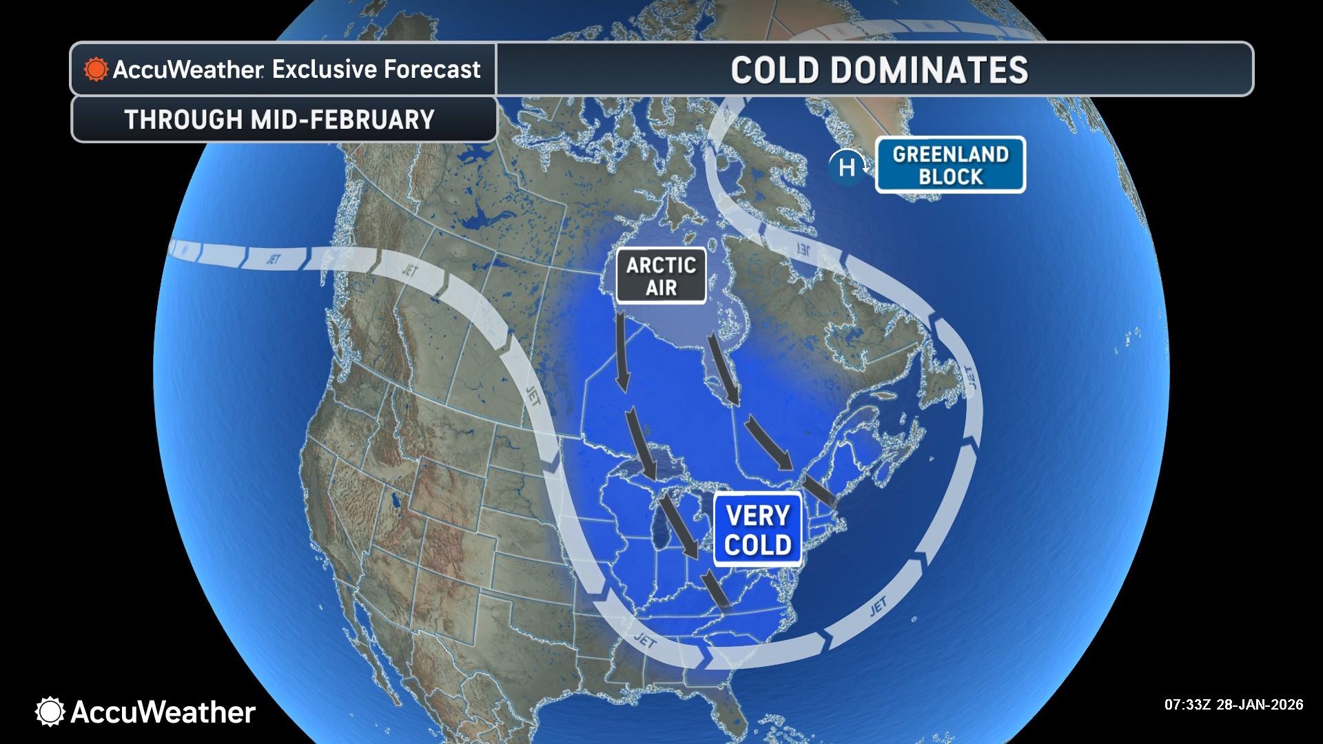
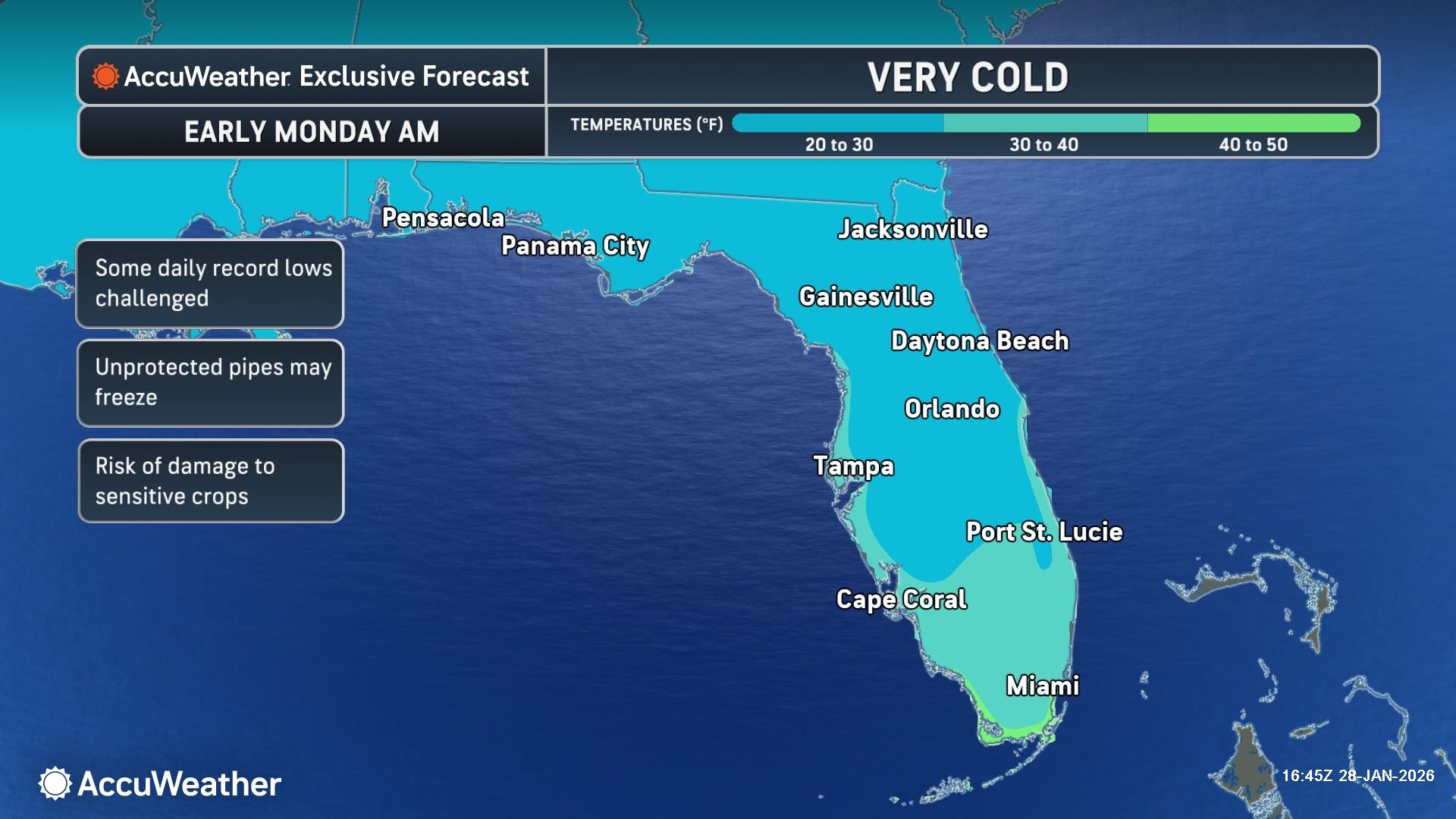
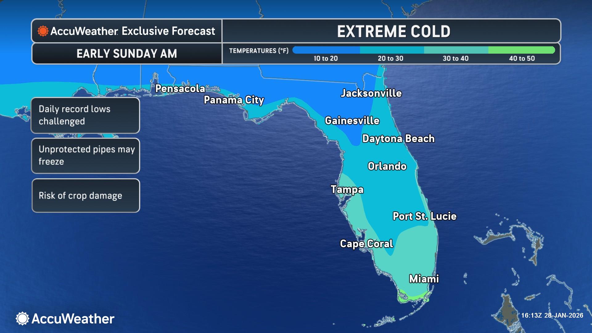

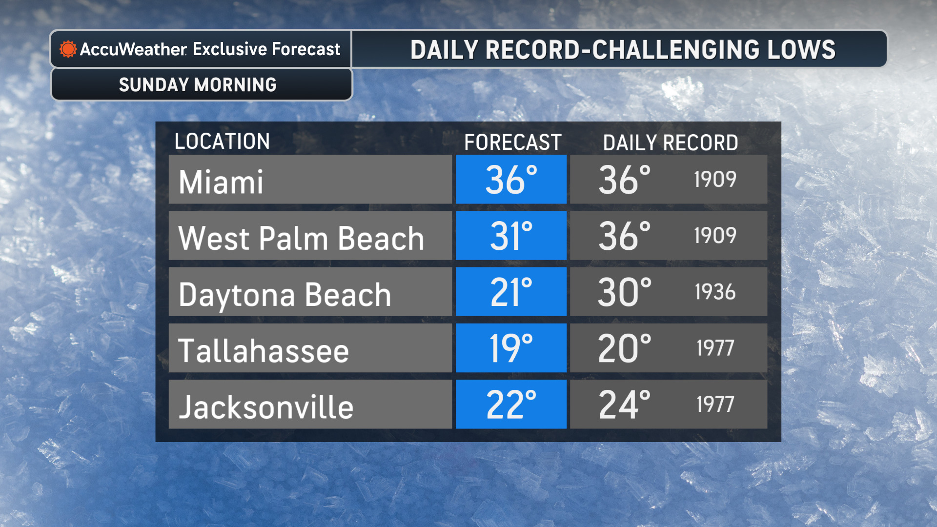
According to the National Weather Service, the next surge of Arctic air is currently diving southward through the Plains and is expected to expand across the Great Lakes, Southeast, and Mid-Atlantic by Friday and Saturday. This air mass is originating from the deep polar regions, and its arrival will be marked by a sharp, sudden drop in temperatures that could catch residents off guard. Wind chill values are expected to drop well below zero in northern tiers, reaching levels where frostbite can occur on exposed skin in a matter of minutes.
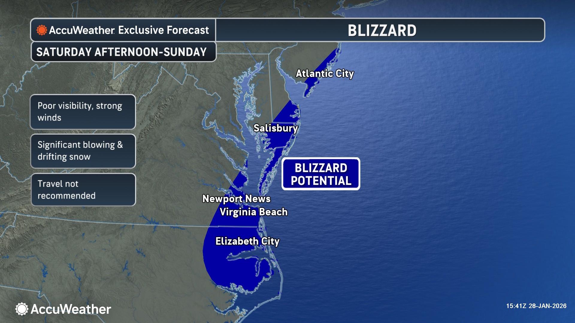
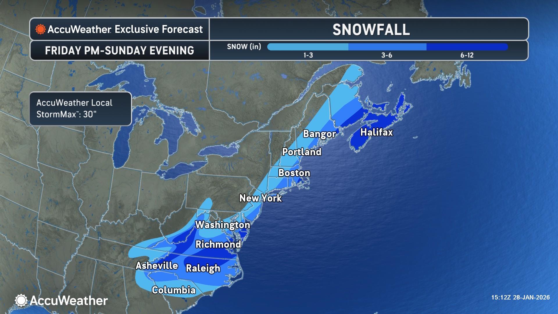
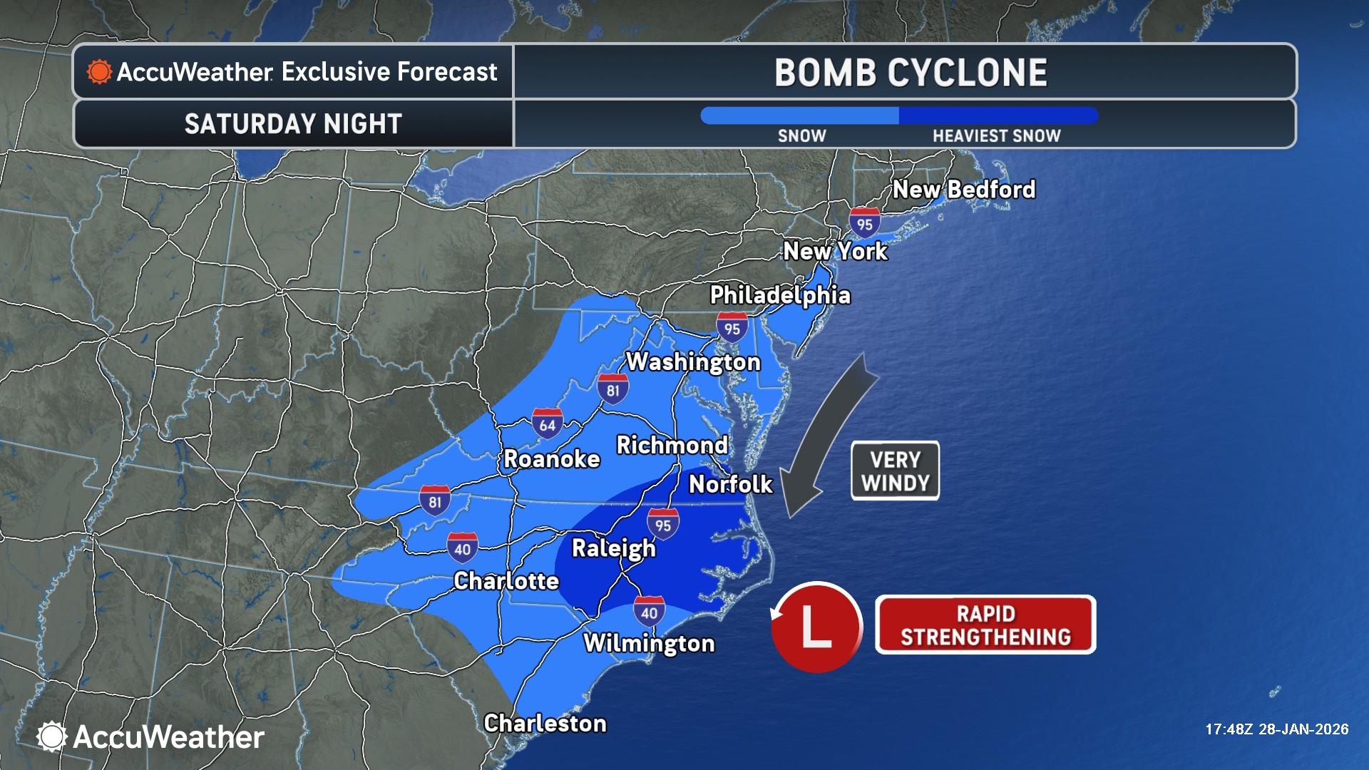
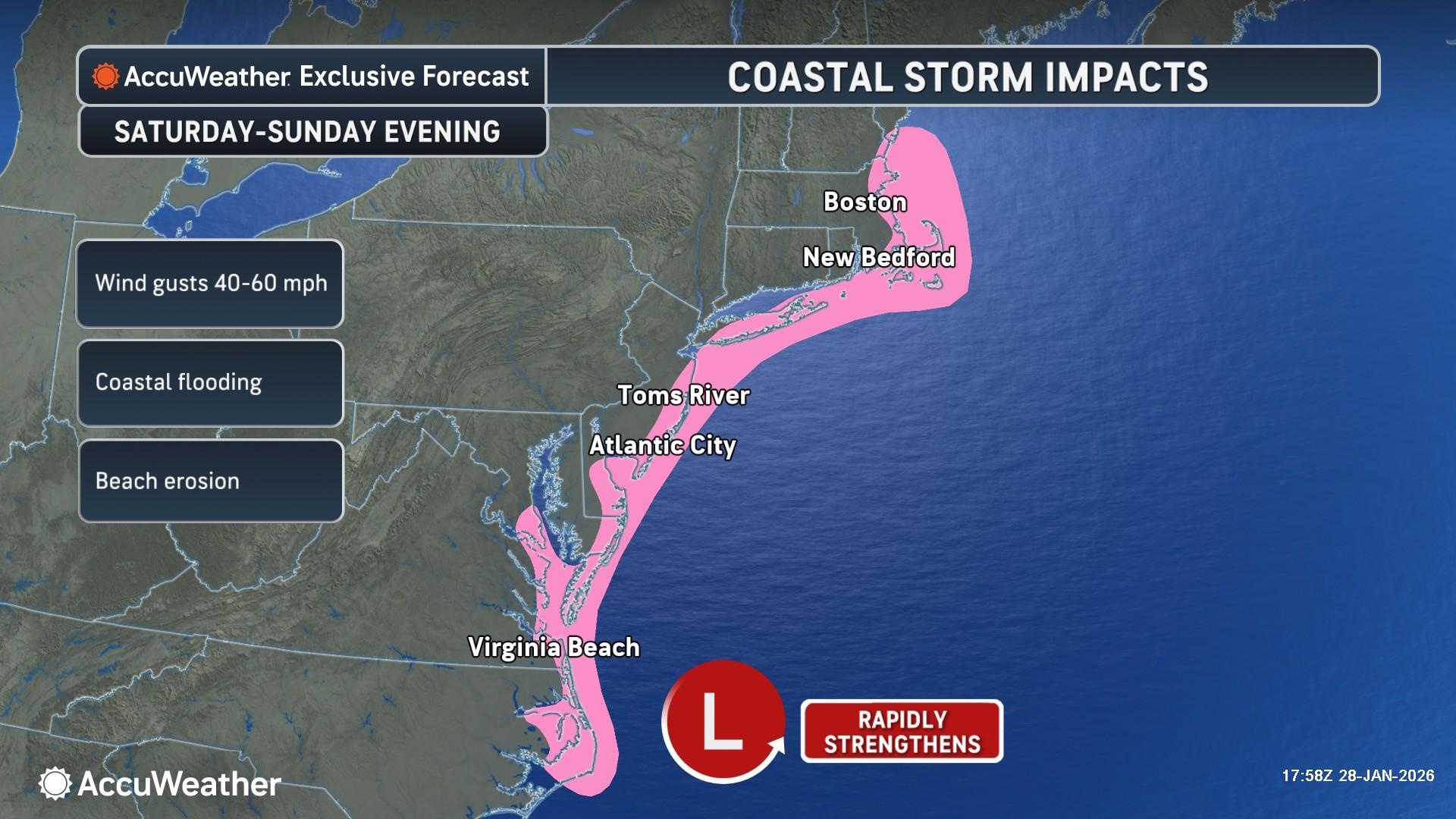
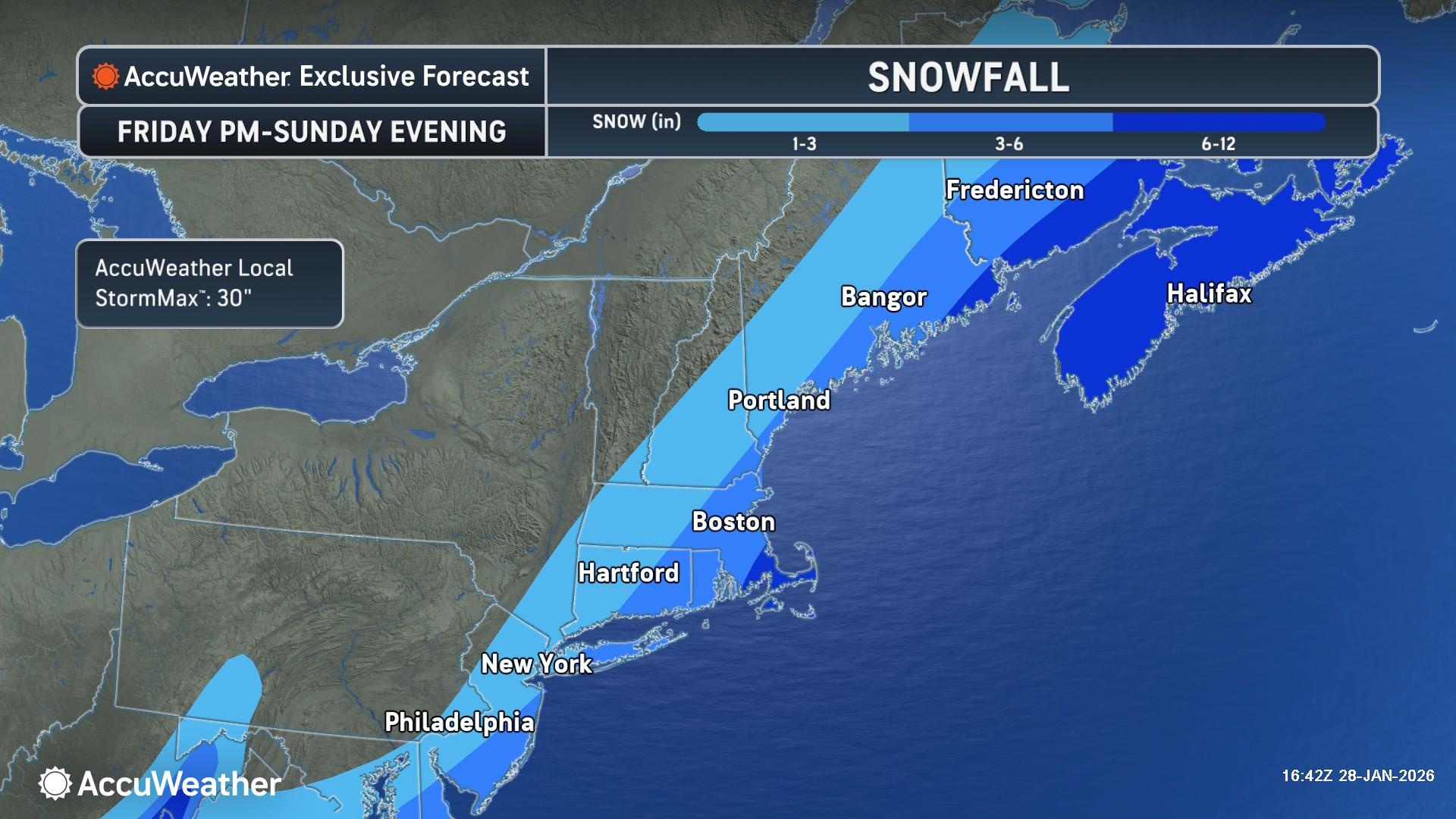
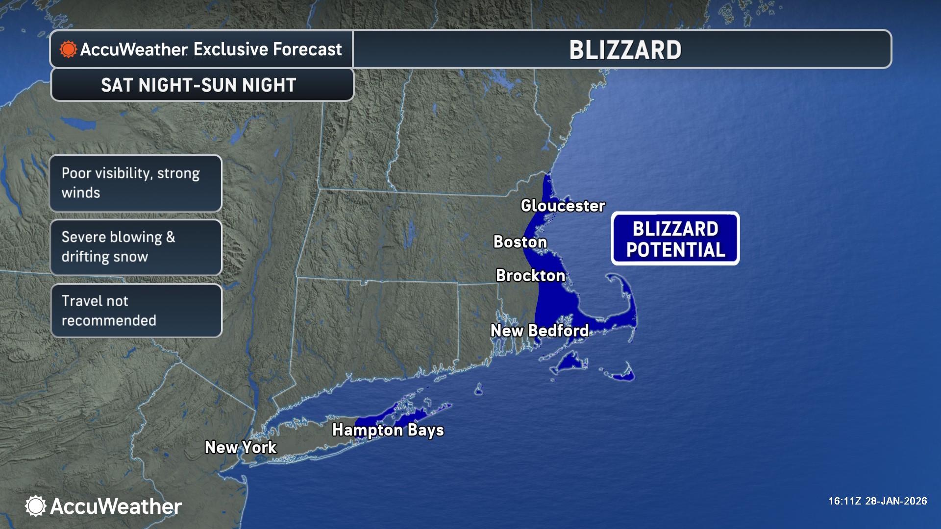
The primary concern for the weekend is a developing storm system along the East Coast. AccuWeather forecasters have been closely monitoring this “Saskatchewan Screamer” as it tracks across the interior U.S. before potentially strengthening into a powerful Nor’easter. While the storm’s exact track remains under scrutiny, confidence is increasing that coastal regions from the Mid-Atlantic to New England will see substantial impacts. For many major metropolitan areas, this could be the first major snow event of 2026, with the potential for over a foot of snow in localized areas if the storm stalls or hugging the coastline.

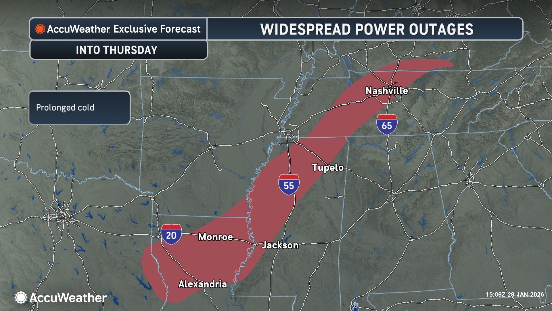
The impacts of this storm are expected to be multifaceted. In the Midwest and Great Lakes, lake-effect snow machines will likely go into overdrive as frigid air moves over the relatively warmer lake waters. This will create “whiteout” conditions and localized snowfall rates of two to three inches per hour. Further east, the heavy, wet snow expected in coastal areas—combined with strengthening winds—poses a significant risk to the power grid. Utility companies are already on high alert, prepositioning crews to handle anticipated outages from snapped branches and downed lines.
Travel is expected to be severely disrupted beginning Thursday night. Major airline hubs in Chicago, Detroit, New York, and Boston are likely to see a wave of cancellations and delays as de-icing operations and runway clearing efforts struggle to keep up with the rate of snowfall. On the ground, state Departments of Transportation are urging motorists to avoid unnecessary travel once the storm begins. The combination of ice and blowing snow is expected to make many secondary roads impassable and turn major interstates into hazardous corridors.
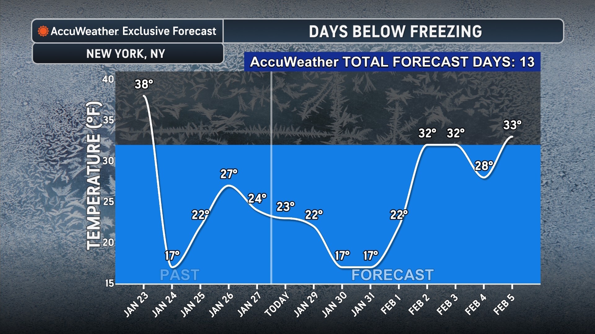
Beyond the snow, the sub-freezing temperatures represent a significant health hazard. Health officials are reminding the public to check on elderly neighbors and ensure that pets have adequate shelter. The “deep freeze” will likely persist for several days after the snow stops falling, meaning that any slush or melted snow on the roads will quickly turn into “black ice,” extending the period of travel danger well into next week.
Infrastructure also faces a stern test. Plumbers are anticipating a surge in calls for frozen pipes, and homeowners are advised to let faucets drip and keep cabinet doors open to allow heat to reach plumbing. For those using space heaters to combat the chill, fire departments are issuing reminders to keep the units at least three feet away from flammable materials and to never leave them unattended.
As the storm moves closer, the precise “rain-snow line” remains the biggest question mark for cities like Philadelphia and Washington, D.C. A slight shift in the storm’s track to the west could bring more rain or a messy mix of sleet and freezing rain, while a shift to the east could keep the heaviest snow totals out at sea. However, even if the snow totals are lower in the southern reach of the storm, the arrival of the Arctic air behind the system ensures that any moisture left on surfaces will freeze solid.
Residents are encouraged to complete their storm preparations—such as stocking up on non-perishable food, water, and batteries—before the first flakes begin to fall. With the potential for the longest-lasting cold snap in recent memory, the primary goal remains safety and the preservation of life during what is shaping up to be a historic winter event.
Sources and Links:
- National Weather Service (NWS): https://www.weather.gov/
- AccuWeather Winter Weather Center: https://www.accuweather.com/en/winter-weather
- National Oceanic and Atmospheric Administration (NOAA): https://www.noaa.gov/
Disclaimer
Artificial Intelligence Disclosure & Legal Disclaimer
AI Content Policy.
To provide our readers with timely and comprehensive coverage, South Florida Reporter uses artificial intelligence (AI) to assist in producing certain articles and visual content.
Articles: AI may be used to assist in research, structural drafting, or data analysis. All AI-assisted text is reviewed and edited by our team to ensure accuracy and adherence to our editorial standards.
Images: Any imagery generated or significantly altered by AI is clearly marked with a disclaimer or watermark to distinguish it from traditional photography or editorial illustrations.
General Disclaimer
The information contained in South Florida Reporter is for general information purposes only.
South Florida Reporter assumes no responsibility for errors or omissions in the contents of the Service. In no event shall South Florida Reporter be liable for any special, direct, indirect, consequential, or incidental damages or any damages whatsoever, whether in an action of contract, negligence or other tort, arising out of or in connection with the use of the Service or the contents of the Service.
The Company reserves the right to make additions, deletions, or modifications to the contents of the Service at any time without prior notice. The Company does not warrant that the Service is free of viruses or other harmful components.


")

")


")