

Thursday features breezy conditions around South Florida and a mix of sun and clouds as a front moves into the mainland. The East Coast metro area will see a few morning showers and then building clouds in the afternoon. Look for plenty of clouds and some showers in the Keys. Flooding is possible in low-lying coastal areas at high tides on Thursday for the next few days as the king tides return. A high risk of dangerous rip currents is in place at the Atlantic beaches on Thursday and into the weekend. Highs on Thursday will be in the low 80s.
Friday will bring breezy conditions and plenty of clouds and showers in the East Coast metro area and the Keys. The Gulf Coast will be breezy and mostly sunny. Friday’s highs will be in the low 80s.
Saturday will feature a strong breeze, some sun and more clouds, and periods of showers in the East Coast metro area and the Keys. Saturday’s highs will be in the low 80s.
Sunday will be breezy again, with a mix of sun and clouds on the mainland and plenty of clouds in the Keys. A few afternoon showers are possible in the East Coast metro area. Sunday’s highs will be in the mid-80s.

Monday’s forecast calls for plenty of sun on the mainland and a mix of sun and clouds in the Keys. Look for a few showers on a brisk breeze in the East Coast metro area. Highs on Monday will be in the mid-80s.
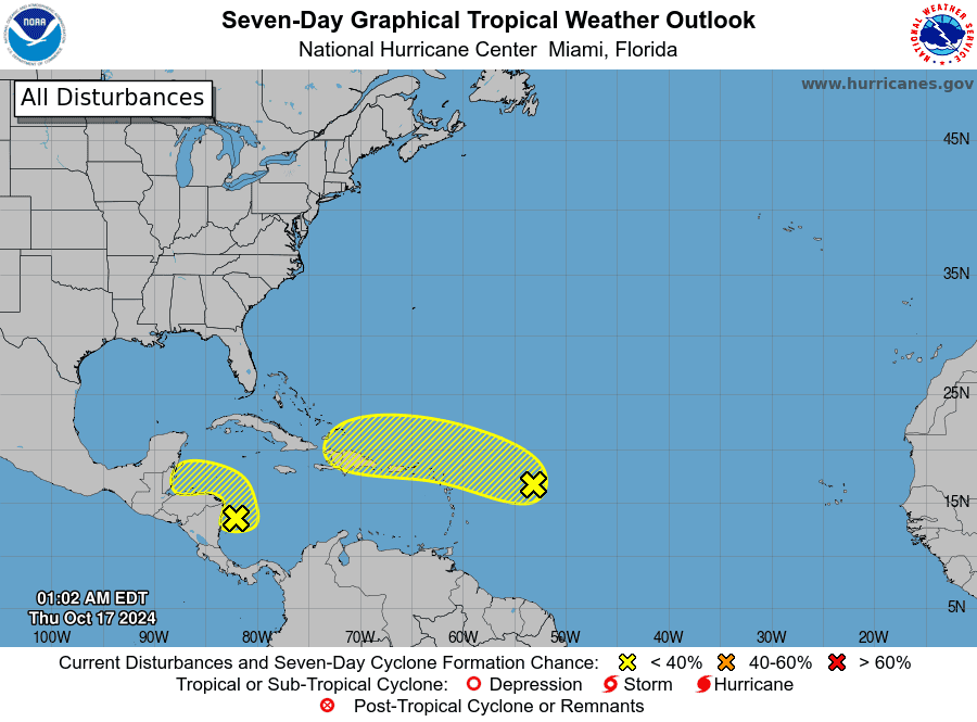 In the tropics, we’re still keeping an eye on the wave in the central Atlantic. The National Hurricane Center gives it a medium chance of becoming a depression when it reaches the Lesser Antilles this weekend. But the possibility of development may be diminishing as the wave continues to battle dry air and will run into strong wind shear. Elsewhere, the area of low pressure in the southwestern Caribbean has a low chance of developing before it reaches the Central American coast, but it will bring very heavy rain and possible flooding to the region.
Disclaimer
Artificial Intelligence Disclosure & Legal Disclaimer
AI Content Policy.
To provide our readers with timely and comprehensive coverage, South Florida Reporter uses artificial intelligence (AI) to assist in producing certain articles and visual content.
Articles: AI may be used to assist in research, structural drafting, or data analysis. All AI-assisted text is reviewed and edited by our team to ensure accuracy and adherence to our editorial standards.
Images: Any imagery generated or significantly altered by AI is clearly marked with a disclaimer or watermark to distinguish it from traditional photography or editorial illustrations.
General Disclaimer
The information contained in South Florida Reporter is for general information purposes only.
South Florida Reporter assumes no responsibility for errors or omissions in the contents of the Service. In no event shall South Florida Reporter be liable for any special, direct, indirect, consequential, or incidental damages or any damages whatsoever, whether in an action of contract, negligence or other tort, arising out of or in connection with the use of the Service or the contents of the Service.
The Company reserves the right to make additions, deletions, or modifications to the contents of the Service at any time without prior notice. The Company does not warrant that the Service is free of viruses or other harmful components.


")
")