Home Accuweather.com First Accumulating Snow of the Season Targets the Northeast This Week

First Accumulating Snow of the Season Targets the Northeast This Week

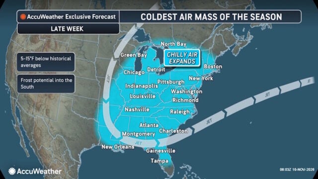
The first accumulating snow of the season could create slippery travel conditions in parts of the Northeast later this week, particularly in higher elevations of Pennsylvania, West Virginia, New York and New England.

Pittsburgh, Syracuse and Binghamton could see their first snowflakes as a developing storm moves east Thursday through Saturday morning. While November snowfall is typical for the interior Northeast, the arrival of wintry conditions after recent warmth could catch some residents off guard.

“There can be a very fine line between rain, snow and accumulating snow when temperatures are in the mid-30s. The intensity of precipitation can make all the difference. Heavier precipitation can briefly cool the air enough for rain to change over to snow, while lighter rain or drizzle may never make that transition. That means two communities just a short distance apart could experience very different conditions,” said AccuWeather expert meteorologist Tyler Roys.

NE WX-1

Where Snow Could Develop

Faith Based Events
  • Pennsylvania and New York: Pittsburgh, Syracuse and Binghamton could see their first flakes, while accumulating snow is possible in higher elevations of western Pennsylvania, along portions of the Pennsylvania-New York border and into the Catskills. Areas near Erie, Pennsylvania are also being monitored.
  • Appalachian Mountains: Higher elevations of West Virginia and southwestern Virginia have the potential for accumulating snow, with slippery spots possible above 2,000 feet
  • Northern New England: Accumulating snow is possible along the spine of the mountains in western New England, from northwestern Connecticut through western Massachusetts and Vermont. Reduced visibility and slippery travel conditions are possible in higher elevations.

The storm could bring a mixture of rain and snow, with gusty winds making AccuWeather RealFeel® Temperatures feel 10-15 degrees colder than actual air temperatures.


Disclaimer

Artificial Intelligence Disclosure & Legal Disclaimer

AI Content Policy.

To provide our readers with timely and comprehensive coverage, South Florida Reporter uses artificial intelligence (AI) to assist in producing certain articles and visual content.

Articles: AI may be used to assist in research, structural drafting, or data analysis. All AI-assisted text is reviewed and edited by our team to ensure accuracy and adherence to our editorial standards.

Images: Any imagery generated or significantly altered by AI is clearly marked with a disclaimer or watermark to distinguish it from traditional photography or editorial illustrations.

General Disclaimer

The information contained in South Florida Reporter is for general information purposes only.

South Florida Reporter assumes no responsibility for errors or omissions in the contents of the Service. In no event shall South Florida Reporter be liable for any special, direct, indirect, consequential, or incidental damages or any damages whatsoever, whether in an action of contract, negligence or other tort, arising out of or in connection with the use of the Service or the contents of the Service.

The Company reserves the right to make additions, deletions, or modifications to the contents of the Service at any time without prior notice. The Company does not warrant that the Service is free of viruses or other harmful components.