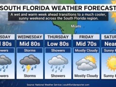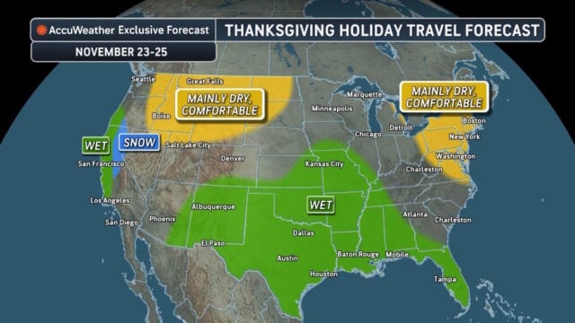
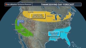
 From backyard football to the drive to Thanksgiving dinner, plans across the Gulf Coast and Southeast may need a rain backup. Rain is possible during Thanksgiving week, with a few thunderstorms capable of bringing heavier rainfall. Some areas could also see rain and cooler conditions on Thanksgiving Day itself.
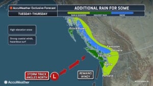 AccuWeather expert meteorologist Chad Merrill notes that a forecast including rain doesn’t automatically mean the whole day is a washout, as timing matters. A downpour during the drive or an outdoor gathering could change plans, while rain overnight may barely interrupt them. Forecasters are closely monitoring whether a southern storm could track toward the Northeast around Thanksgiving or remain close to the Southeast coast.
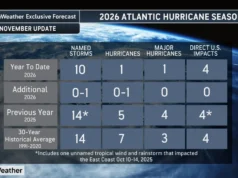
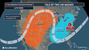 While the South prepares for potential wet weather, a strengthening El Niño is contributing to exceptional warmth across the central United States. More than two dozen U.S. cities—including Dallas, Houston, Oklahoma City, and St. Louis—recorded their warmest start to meteorological fall from September 1 through November 5. AccuWeather expert meteorologist Alyssa Glenny explains that a persistent southward dip in the jet stream across the West and a northward bend from the Mississippi Valley to the Appalachians helped funnel warm air into the central states. South-southwest breezes sustained the warmth and limited overnight cooling. This domestic heat mirrors global milestones, as October finished as the warmest October ever measured worldwide, surpassing the previous record set in 2023.
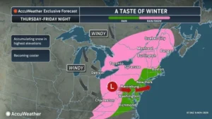 In stark contrast, a developing storm could bring the season’s first snow to parts of the Great Lakes and Northeast late this week as the coldest air of the season sweeps across the East. A southward dip in the jet stream will allow colder Canadian air to sweep in, organizing a storm that will move east from the Great Lakes. This system could bring wet snow mixed with rain from the Appalachians into the interior Northeast Thursday into Friday night. Snow accumulation is most likely at higher elevations, especially in the mountains of West Virginia. Lower elevations may see snowflakes mix in with rain without accumulating, but windy conditions from Thursday through Saturday will drive RealFeel temperatures 10 to 15 degrees below actual air temperatures.

Sources:
Disclaimer
Artificial Intelligence Disclosure & Legal Disclaimer
AI Content Policy.
To provide our readers with timely and comprehensive coverage, South Florida Reporter uses artificial intelligence (AI) to assist in producing certain articles and visual content.
Articles: AI may be used to assist in research, structural drafting, or data analysis. All AI-assisted text is reviewed and edited by our team to ensure accuracy and adherence to our editorial standards.
Images: Any imagery generated or significantly altered by AI is clearly marked with a disclaimer or watermark to distinguish it from traditional photography or editorial illustrations.
General Disclaimer
The information contained in South Florida Reporter is for general information purposes only.
South Florida Reporter assumes no responsibility for errors or omissions in the contents of the Service. In no event shall South Florida Reporter be liable for any special, direct, indirect, consequential, or incidental damages or any damages whatsoever, whether in an action of contract, negligence or other tort, arising out of or in connection with the use of the Service or the contents of the Service.
The Company reserves the right to make additions, deletions, or modifications to the contents of the Service at any time without prior notice. The Company does not warrant that the Service is free of viruses or other harmful components.