|
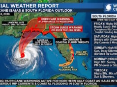
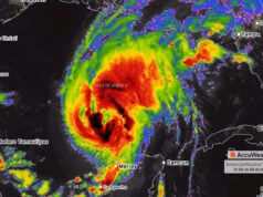
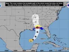
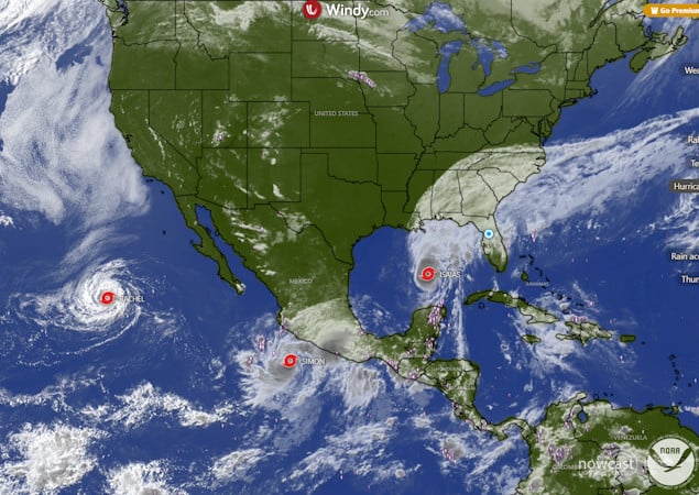
A triple play of tropical threats will impact the U.S. this weekend as storms in both the Atlantic and Pacific basins slam the U.S. In the Gulf, Hurricane Isaias is the latest first-forming hurricane in the Atlantic Basin among seasons that produced at least one hurricane, breaking the previous record set in 1905 by approximately 3.5 hours. If Isaias makes landfall as a hurricane as forecast, it will mark exactly two years to the day since Hurricane Milton struck Florida on Oct. 9, 2024. Isaias would be the first hurricane to make landfall in the United States since Milton in the Atlantic Basin. “We’ve gone from a historic stretch without a hurricane to a potentially destructive storm threatening the Gulf Coast in a matter of days,” said AccuWeather expert meteorologist Dan Pydynowski. “El Niño has helped suppress hurricane activity across the Atlantic this season, but it hasn’t eliminated the threat. Even in an unusually quiet season, it only takes one hurricane to have devastating consequences for communities in its path.” The Category 1 hurricane is forecast to strengthen into a Category 2 before making landfall just east of Mobile Bay, Alabama, Friday night. AccuWeather hurricane experts say Isaias could become a major hurricane before reaching the coast, bringing life-threatening storm surge, damaging winds, flooding rainfall tornadoes and widespread power outages. You Can Track Live Hurricane Updates Here Isaias is rated a 2 on the AccuWeather Real Impact™ Scale for Hurricanes in the United States, due to flooding rainfall, damaging winds and life-threatening storm surge. The storm also poses a significant tornado threat across southern Alabama, the Florida Panhandle and southwestern Georgia Friday through Saturday night, with the risk shifting into the Carolinas and eastern Tennessee Sunday. Heavy rain could spread into the Ohio Valley, mid-Atlantic and southern New England early next week, with flash flooding and mudslides possible in the Appalachians. |

 |
 |
.jpg?width=1120&upscale=true&name=HD33%20(1).jpg) |
 |
Disclaimer
Artificial Intelligence Disclosure & Legal Disclaimer
AI Content Policy.
To provide our readers with timely and comprehensive coverage, South Florida Reporter uses artificial intelligence (AI) to assist in producing certain articles and visual content.
Articles: AI may be used to assist in research, structural drafting, or data analysis. All AI-assisted text is reviewed and edited by our team to ensure accuracy and adherence to our editorial standards.
Images: Any imagery generated or significantly altered by AI is clearly marked with a disclaimer or watermark to distinguish it from traditional photography or editorial illustrations.
General Disclaimer
The information contained in South Florida Reporter is for general information purposes only.
South Florida Reporter assumes no responsibility for errors or omissions in the contents of the Service. In no event shall South Florida Reporter be liable for any special, direct, indirect, consequential, or incidental damages or any damages whatsoever, whether in an action of contract, negligence or other tort, arising out of or in connection with the use of the Service or the contents of the Service.
The Company reserves the right to make additions, deletions, or modifications to the contents of the Service at any time without prior notice. The Company does not warrant that the Service is free of viruses or other harmful components.