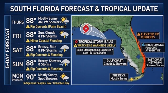
Thursday features a mostly sunny morning and afternoon showers in the East Coast metro area. The Gulf Coast will see some sun, more clouds, and plenty of showers, while the Keys will be mostly sunny with the chance of a shower in spots. Expect an elevated risk of dangerous rip currents along the Palm Beach County coast. Thursday’s highs will be in the upper 80s.
Friday will bring good sun, some clouds, and a few afternoon storms to the East Coast metro area. The Gulf cCoast will see a mix of sun, clouds, a few morning storms and afternoon showers. The Keys will be mostly sunny with a shower in spots. Expect minor coastal flooding near high tides through the weekend. Friday’s highs will be in the upper 80s.
Saturday will feature breezy conditions, a mix of sun and clouds, morning showers, and afternoon storms in the East Coast metro area. The Gulf Coast and the Keys will be breezy with mostly sunny skies and periods of showers. Expect an elevated risk of dangerous rip currents at the Atlantic beaches and minor coastal flooding near high tides around South Florida. Saturday’s highs will be in the upper 80s.
Sunday will be breezy with more clouds than sun and periods of showers and storms in the East Coast metro area. The Gulf Coast and the Keys will be mostly sunny, with a few showers or storms as well near the Gulf Coast. Expect an elevated risk of dangerous rip currents at the Atlantic beaches and minor coastal flooding near high tides around South Florida. Sunday’s highs will be mostly in the upper 80s.

The forecast for Indigenous Peoples’ Day/Columbus Day calls for mostly sunny skies and the chance of a shower or storm, especially on the mainland. Highs on Monday will be near 90 degrees in the East Coast metro area and in the upper 80s along the Gulf Coast and in the Keys.
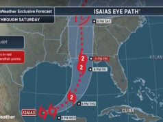
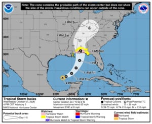 Tropical Depression # 9 became Tropical Storm Isaias early Wednesday morning, and it is forecast to become the first hurricane of the Atlantic season by Thursday morning. Isaias is forecast to make landfall along the northern Gulf coast late Friday night or early on Saturday. There’s a hurricane watch from Bay St. Louis, Mississippi to Indian Pass in the Florida panhandle. There’s a tropical storm watch from Bay St. Louis to the Jefferson / Plaquemines Parish line in Louisiana and from Indian Pass to the Aucilla River in Florida.
Disclaimer
Artificial Intelligence Disclosure & Legal Disclaimer
AI Content Policy.
To provide our readers with timely and comprehensive coverage, South Florida Reporter uses artificial intelligence (AI) to assist in producing certain articles and visual content.
Articles: AI may be used to assist in research, structural drafting, or data analysis. All AI-assisted text is reviewed and edited by our team to ensure accuracy and adherence to our editorial standards.
Images: Any imagery generated or significantly altered by AI is clearly marked with a disclaimer or watermark to distinguish it from traditional photography or editorial illustrations.
General Disclaimer
The information contained in South Florida Reporter is for general information purposes only.
South Florida Reporter assumes no responsibility for errors or omissions in the contents of the Service. In no event shall South Florida Reporter be liable for any special, direct, indirect, consequential, or incidental damages or any damages whatsoever, whether in an action of contract, negligence or other tort, arising out of or in connection with the use of the Service or the contents of the Service.
The Company reserves the right to make additions, deletions, or modifications to the contents of the Service at any time without prior notice. The Company does not warrant that the Service is free of viruses or other harmful components.