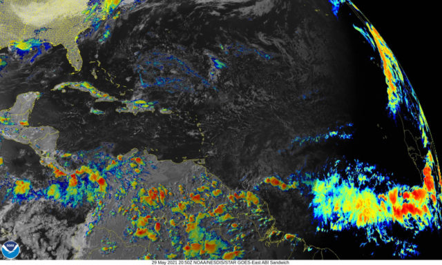
If you think we’ve seen more tropical storms and hurricanes in recent years, you’re right. Meteorologists at NOAA are acknowledging that in the latest update of what we can expect during a “typical” Atlantic hurricane season. At the end of each decade, they revise what are called climate normals to incorporate the most recent 30 years of data. Since we’re now using hurricane and tropical storm data from 1991 through 2020, that typical season would include:
- 14 named storms (total tropical storms and hurricanes)
- 7 hurricanes (categories 1 through 5)
- 3 major hurricanes (category 3 and above)
That’s in contrast to the old numbers of 12 named storms, 6 hurricanes, and 2 to 3 major hurricanes in a “typical” Atlantic season. The new numbers indicate that we’re not out of the more active hurricane cycle that we’ve been in since 1995.
Speaking of numbers, here are the maximum sustained wind speeds associated with Atlantic tropical systems:
- tropical storm 39 through 73 mph
- category 1 hurricane 74 through 95 mph
- category 2 hurricane 96 through 110 mph
- category 3 hurricane 111 through 129 mph
- category 4 hurricane 130 through 156 mph
- category 5 hurricane 157 mph and above
There’s also a new date to remember: May 15. That’s when the National Hurricane Center will begin their daily Tropical Weather Outlook – a graphic and text summary of what’s happening in the tropical Atlantic now and in the next 2 or 5 days. You can find it on their homepage through November 30: https://www.nhc.noaa.gov/
That’s another change related to our changing hurricane climatology. While the Atlantic hurricane season “officially” begins on June 1 each year, we’ve seen several recent seasons (including 2020) that had at least one tropical system form earlier. That’s why the National Hurricane Center is issuing the Tropical Weather Outlook a couple of weeks before June 1 – and it’s another reminder that our new hurricane reality includes longer and more active hurricane seasons.
Disclaimer
Artificial Intelligence Disclosure & Legal Disclaimer
AI Content Policy.
To provide our readers with timely and comprehensive coverage, South Florida Reporter uses artificial intelligence (AI) to assist in producing certain articles and visual content.
Articles: AI may be used to assist in research, structural drafting, or data analysis. All AI-assisted text is reviewed and edited by our team to ensure accuracy and adherence to our editorial standards.
Images: Any imagery generated or significantly altered by AI is clearly marked with a disclaimer or watermark to distinguish it from traditional photography or editorial illustrations.
General Disclaimer
The information contained in South Florida Reporter is for general information purposes only.
South Florida Reporter assumes no responsibility for errors or omissions in the contents of the Service. In no event shall South Florida Reporter be liable for any special, direct, indirect, consequential, or incidental damages or any damages whatsoever, whether in an action of contract, negligence or other tort, arising out of or in connection with the use of the Service or the contents of the Service.
The Company reserves the right to make additions, deletions, or modifications to the contents of the Service at any time without prior notice. The Company does not warrant that the Service is free of viruses or other harmful components.


