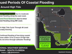
 Friday features plenty of hot sun in the morning, but clouds, showers, and storms will move in during the afternoon, thanks to an area of disturbed weather just to our east. That will make for a soggy Friday night and a weekend washout. Highs on Friday will be in the steamy low 90s.
LIVE RADAR 24/7 (Click Here Then Press Play)
Saturday will be a day of clouds, showers, and storms as we continue to deal with moisture from the disturbance. Saturday’s highs will be near 90 degrees.
Sunday will feature some sun, more clouds, and periods of showers and storms. Sunday’s highs will be in the low 90s.
Monday will continue the trend of sun and clouds in the morning and widespread showers and some storms in the afternoon. Monday’s highs will be in the low 90s.
Tuesday’s forecast includes a mix of sun and clouds with periods of showers and storms. Highs on Tuesday will be in the low 90s again.
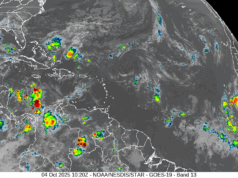
 The tropics are insanely busy. We’re keeping an eye on the disorganized showers and storms that will affect us this weekend. This area has a very low chance of developing this weekend. But it does have a medium chance of becoming a depression after it enters the Gulf and as it tracks in the direction of the Louisiana coast. In the northeastern Gulf of Mexico, a trough of low pressure has a low chance of developing as it moves generally to the southwest toward the Mexican coast..
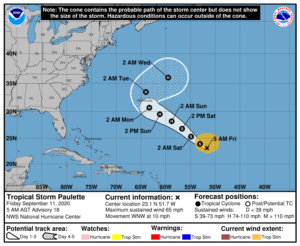
 Our two tropical storms continue their treks across the Atlantic. Tropical Storm Paulette is expected to become a hurricane this weekend. At 5 am Friday, Paulette was located near 23.1 North, 51.7 West, a little over 1000 miles southeast of Bermuda. Maximum sustained winds were 65 miles per hour, and Paulette was moving west-northwest at 10 miles per hour. Paulette will make its closest approach to Bermuda on Monday into Tuesday.
 To the east, Tropical Storm Rene had maximum sustained winds of 45 miles per hour early on Friday. At 5 am, Rene was located near 19.7 North, 38.5 West, and was moving west-northwest at 10 miles per hour. Rene is forecast to remain in the open ocean.
We’re also watching some waves that are far away. The wave that recently entered the eastern Atlantic has a high chance of becoming a depression in the next few days. We’ll keep an eye on it. Finally, yet another wave is expected to emerge from western Africa, and this one will have a medium chance of development in the eastern Atlantic.
Disclaimer
The information contained in South Florida Reporter is for general information purposes only.
The South Florida Reporter assumes no responsibility for errors or omissions in the contents of the Service.
In no event shall the South Florida Reporter be liable for any special, direct, indirect, consequential, or incidental damages or any damages whatsoever, whether in an action of contract, negligence or other tort, arising out of or in connection with the use of the Service or the contents of the Service. The Company reserves the right to make additions, deletions, or modifications to the contents of the Service at any time without prior notice.
The Company does not warrant that the Service is free of viruses or other harmful components


