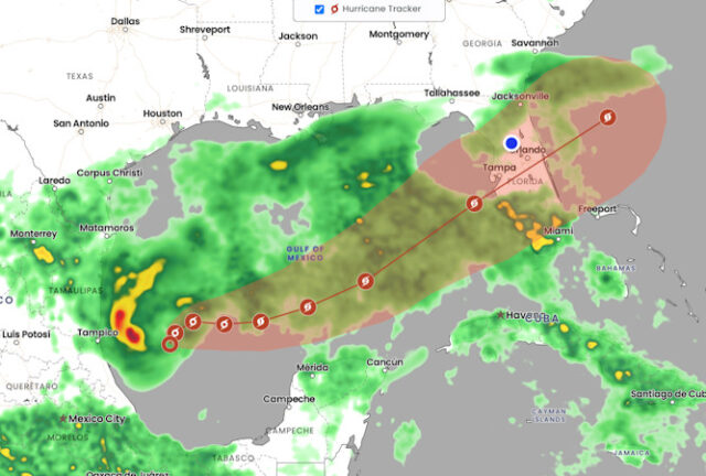
The big weather story this week will be the tropical system that is now Tropical Storm Milton but will soon be a hurricane. Milton is likely to affect virtually all of Florida on Tuesday and Wednesday. The exact track of this system is uncertain, but all of the Gulf Coast from the eastern part of the panhandle down to Naples could potentially see a landfalling hurricane.

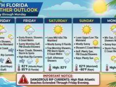
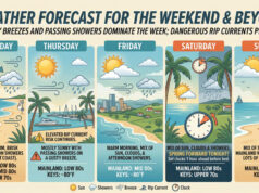
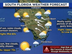
Sunday features mostly cloudy skies and periods of showers in the East Coastt metro area and showers and storms along the Gulf Coast and in the Keys. Heavy rain is possible in spots. Expect a high risk of dangerous rip currents along the Palm Beach County coast and an elevated rip current risk at the beaches of Miami-Dade and Broward. Highs on Sunday will be mostly in the mid-80s.
Monday will feature clouds and showers and maybe a storm. Heavy rain and localized flooding are possible. Look for increasingly gusty winds on Monday evening. Monday’s highs will be in the mid-80s.
Tuesday’s weather will depend on Tropical Storm Milton. For now, we’ll say we’ll see increasingly breezy conditions and periods of showers and storms during the day and possibly tropical storm conditions beginning in the evening. Heavy rain and localized flooding are possible. Tuesday’s highs will be mostly in the mid-80s.
Wednesday could see tropical storm conditions or even hurricane conditions – depending on the track, intensity, and size of TS Milton. At the least, it will be windy with heavy and potentially flooding rains and possible storm surge along the Gulf coast and in the Keys. Wednesday’s highs will be mostly in the upper 80s.
Thursday’s forecast will again depend on the tropics, but for now we’ll expect breezy conditions, periods of showers and storms, and some sun but more clouds. Highs on Thursday will be mostly in the upper 80s.
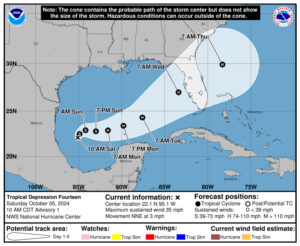 Our look at the tropics is dominated by Tropical Storm Milton in the southwestern Gulf of Mexico. This system will strengthen and accelerate, putting most of Florida at risk of hurricane or tropical storm conditions, starting on Tuesday and lasting through Wednesday. Now is the time to top off your hurricane supplies, know where you’d go if you’re told to evacuate, and if you’re staying, plan on putting up shutters no later than noon on Tuesday, depending on the extent of the watch and warning areas.
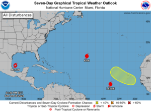 Elsewhere, Hurricane Kirk is now moving to the northeast in the Atlantic and will affect portions of Europe later this week as a post-tropical cyclone. Hurricane Leslie is moving northwestward in the central Atlantic and is expected to weaken into a tropical storm on Monday, far from land. Finally, a wave is expected to emerge from the African coast on Monday or Tuesday. This wave has a low chance of becoming a depression in the next several days, but it will move over the Cabo Verde Islands on Wednesday or Thursday, bringing heavy rain and gusty winds.
Disclaimer
Artificial Intelligence Disclosure & Legal Disclaimer
AI Content Policy.
To provide our readers with timely and comprehensive coverage, South Florida Reporter uses artificial intelligence (AI) to assist in producing certain articles and visual content.
Articles: AI may be used to assist in research, structural drafting, or data analysis. All AI-assisted text is reviewed and edited by our team to ensure accuracy and adherence to our editorial standards.
Images: Any imagery generated or significantly altered by AI is clearly marked with a disclaimer or watermark to distinguish it from traditional photography or editorial illustrations.
General Disclaimer
The information contained in South Florida Reporter is for general information purposes only.
South Florida Reporter assumes no responsibility for errors or omissions in the contents of the Service. In no event shall South Florida Reporter be liable for any special, direct, indirect, consequential, or incidental damages or any damages whatsoever, whether in an action of contract, negligence or other tort, arising out of or in connection with the use of the Service or the contents of the Service.
The Company reserves the right to make additions, deletions, or modifications to the contents of the Service at any time without prior notice. The Company does not warrant that the Service is free of viruses or other harmful components.


