
Tropical storm conditions are expected in the east coast metro area on Saturday as Hurricane Isaias makes its closest approach to us from the afternoon hours into Sunday morning. A tropical storm warning is in effect from Ocean Reef to the south of Boca Raton. A hurricane watch is also in effect from Hallandale Beach to Boca Raton. A hurricane warning is in effect from Boca Raton to the Brevard/Volusia county line. A hurricane warning remains in effect for the central and northwestern Bahamas.
LIVE RADAR 24/7 (Click Here Then Press Play)
 At 5 am Saturday, Isaias was located near 23.9 North, 77.1 West, about 80 miles south-southeast of Nassau and 210 miles south-southeast of Grand Bahama Island. Maximum sustained winds were 85 miles per hour, and Isaias was moving northwest at 12 miles per hour. Dry air intrusion and wind shear are affecting Isaias early on Saturday. It is also possible that an anticipated turn to the north-northwest has begun.
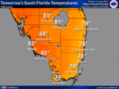
 Here’s what we can expect on Saturday into Sunday. Periods of tropical storm-force winds are very likely in Miami-Dade, especially in northeastern portions of the county. Prolonged periods of tropical storm-force winds and stronger gusts are expected in Broward, especially in northeastern sections on or near the coast. Periods of heavy rain with an accumulation of 2 to 4 inches are forecast for the entire east coast metro area. Storm surge flooding of 1 to 3 feet is possible in northeast Broward and southern Palm Beach County. The Gulf coast will see cloudy skies, periods of showers and storms, and breezy conditions on Saturday. Highs on Saturday will be in the upper 80s in the east coast metro area and the low 90s along the Gulf coast.
Sunday will begin with gusty winds and periods of showers and storms in the east coast metro area. Wind and rain will taper off, from south to north, during the day on Sunday. The Gulf coast will see a mix of sun, clouds, and showers on the breeze. Sunday’s highs will be mostly in the low 90s.
Monday will feature plenty of clouds, some sun, and periods of showers and storms. Monday’s highs will be in the low 90s.
Tuesday will bring a mix of sun and clouds to the Gulf coast and mostly cloudy skies in the east coast metro area. All of South Florida will see widespread showers and storms. Tuesday’s highs will be near 90 degrees.
Wednesday’s forecast calls for lots of clouds, a bit of sun, and widespread showers and storms. Highs on Wednesday will be near 90 degrees.
Elsewhere in the tropics, the wave in the eastern Atlantic is now Tropical Depression # 10, but it is forecast to become a remnant low by Sunday. The wave in the central Atlantic has a medium chance of developing during the next 5 days.


