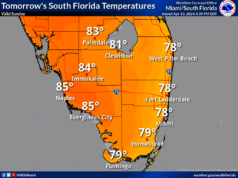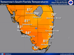
 LIVE RADAR: (Press play) The day features a mix of sun and clouds with showers and storms popping up mainly in the afternoon. An elevated risk of dangerous rip currents remains at the Atlantic beaches. Highs on Sunday will be in the upper 80s along the Gulf coast and the low 90s elsewhere, but it will feel about 10 degrees hotter throughout South Florida.
Monday will bring sun, clouds, and passing showers and storms. Monday’s highs will be mostly in the low 90s.
Tuesday will feature good sun, clouds at times, and the chance of a shower or storm in spots. Tuesday’s highs will be in the low 90s.
Look for more of the same on Wednesday — plenty of sun, a few clouds, and an isolated shower or storm. Wednesday’s highs will be in the low 90s.
Thursday will be another mostly sunny and mostly dry day. Highs on Thursday will be near 90 degrees.
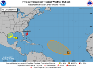
 Tropical Storm Humberto continues its slow movement well east of Florida. At 5 am Sunday, Humberto was located near 28.3 North, 77.7 West, about 175 miles east of Cape Canaveral. Humberto was moving north-northwest at 7 miles per hour. Maximum sustained winds were 60 miles per hour. Humberto is forecast to reach hurricane strength and brush by Bermuda later in the week. It will bring heavy swells and dangerous rip currents to most of the southeast U.S. coast this week.
 Elsewhere in the tropics, the area of showers in the eastern Gulf of Mexico has a low chance of developing as it approaches the Texas coast in a couple of days. The wave that’s now well to the southwest of the Cape Verde Islands has at least a medium chance of developing during the next several days as it moves generally westward.


