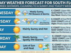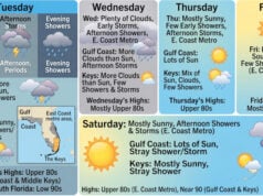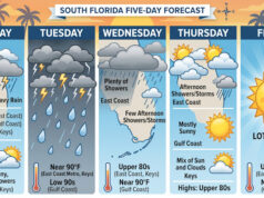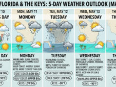
 Saturday features plenty of sun, a few clouds, and maybe a passing shower in the morning. Showers and storms will develop in the mid to late afternoon. The east coast metro area will see a gusty ocean breeze. A moderate risk of dangerous rip currents remains at the Atlantic beaches on Saturday and through the holiday weekend. Highs on Saturday will be in the low 90s — but it will feel about 10 degrees hotter, so stay hydrated.
LIVE RADAR 24/7 (Click Here Then Press Play)
Sunday will bring good sun and a few clouds in the morning. Showers and storms will be back in the afternoon. Sunday’s highs will be in the low 90s.
Labor Day will feature plenty of sun to start the day. Showers and storms will be around, mostly in the mid to late afternoon. Monday’s highs will be in the low 90s.
Tuesday will see sunny skies much of the day, but the afternoon will feature periods of showers and storms. Tuesday’s highs will be in the low 90s.
Wednesday’s forecast calls for lots of hot sun with periods of showers and storms. Highs on Wednesday will be in the low 90s again.
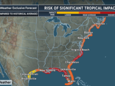
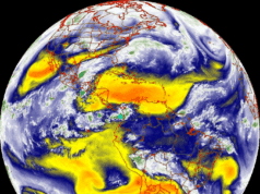
 In the tropics, the low east of the Leeward Islands is now Tropical Storm Earl. At 5 am, Earl was located near 18.7 North, 61.4 West, about 115 miles east-northeast of the Leeward Islands. Maximum sustained winds were 40 miles per hour, and Earl was moving west-northwest at 13 miles per hour. Earl is expected to pass to the north of the Leeward Islands on Saturday and remain well to the east of the Bahamas before recurving into the open Atlantic.
 Danielle became the first hurricane of the 2022 Atlantic season, but it weakened to a tropical storm by early Saturday. At 5 am, Danielle was located about 915 miles west of the Azores. Maximum sustained winds were 70 miles per hour. Danielle has been moving very slowly, but it is expected to restrengthen and accelerate to the northeast early next week.
Disclaimer
Artificial Intelligence Disclosure & Legal Disclaimer
AI Content Policy.
To provide our readers with timely and comprehensive coverage, South Florida Reporter uses artificial intelligence (AI) to assist in producing certain articles and visual content.
Articles: AI may be used to assist in research, structural drafting, or data analysis. All AI-assisted text is reviewed and edited by our team to ensure accuracy and adherence to our editorial standards.
Images: Any imagery generated or significantly altered by AI is clearly marked with a disclaimer or watermark to distinguish it from traditional photography or editorial illustrations.
General Disclaimer
The information contained in South Florida Reporter is for general information purposes only.
South Florida Reporter assumes no responsibility for errors or omissions in the contents of the Service. In no event shall South Florida Reporter be liable for any special, direct, indirect, consequential, or incidental damages or any damages whatsoever, whether in an action of contract, negligence or other tort, arising out of or in connection with the use of the Service or the contents of the Service.
The Company reserves the right to make additions, deletions, or modifications to the contents of the Service at any time without prior notice. The Company does not warrant that the Service is free of viruses or other harmful components.


