


 Sunday features good sun and a few clouds in the morning, followed by passing showers and storms starting in the mid-afternoon. Much of the activity will be well inland, but outlying portions of the metro areas could see some storms develop. Highs on Sunday will be in the upper 80s.
LIVE RADAR 24/7 (Click Here Then Press Play)
Monday morning will see a mix of sun and clouds, along with a few east coast showers. Then we’ll see periods of showers and storms in the afternoon. Monday’s highs will be mostly in the upper 80s.
Tuesday will feature plenty of clouds and a few early showers along the Gulf coast. The afternoon will bring periods of showers and storms and a building breeze along the Atlantic coast. Tuesday’s highs will be in the mid to upper 80s.
Wednesday will bring a mix of sun and clouds to the Gulf coast, while the east coast metro area will see mostly cloudy skies. Showers and storms will develop during the afternoon. Wednesday’s highs will be in the mid to upper 80s.
Thursday’s forecast calls for a mix of sun, clouds, showers, and a few storms. Highs on Thursday will be in the upper 80s.
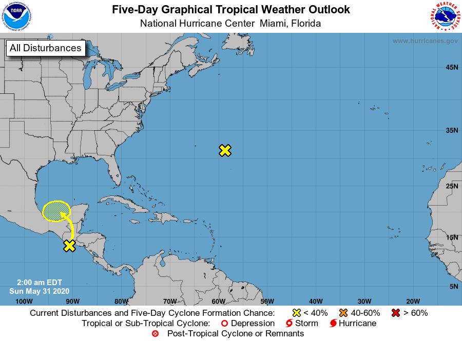 In the tropics, the low in the central Atlantic is now encountering conditions unfavorable for tropical or subtropical development. But it’s a reminder that the 2020 Atlantic hurricane season officially starts tomorrow.


