


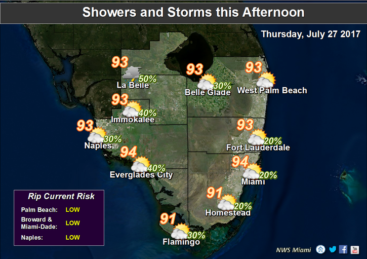
 South Florida is still dangerously hot on Thursday and will be for a few more days. After a very warm start with a few passing showers (especially in the Keys), Thursday features hot sun, building clouds, and passing showers and storms as the sea breeze develops. Conditions remain oppressive, and highs on Thursday will be mostly in the mid 90s but will feel about 10 degrees hotter. Whether or not an official heat advisory is issued, it’s important to stay hydrated and out of the sun.
Friday will see some moisture move in on a southwesterly wind, so look for showers and storms to develop during the afternoon. Friday’s highs will be in the low to mid 90s — and feeling hotter again.
Saturday will be hotter yet, and early sun and clouds will give way to afternoon showers and storms. Saturday’s highs will be in the mid 90s in most of the metro area, with upper 90s possible in the western suburbs.
Sunday will be another day of scorching heat alternating with showers and storms. Highs on Sunday will be in the mid to upper 90s.
 In the tropics, a wave in the eastern Atlantic has a low chance of developing into a depression during the next 5 days.


