Home Weather Warm Again Today As Weakening Front Approaches

Warm Again Today As Weakening Front Approaches

warm again

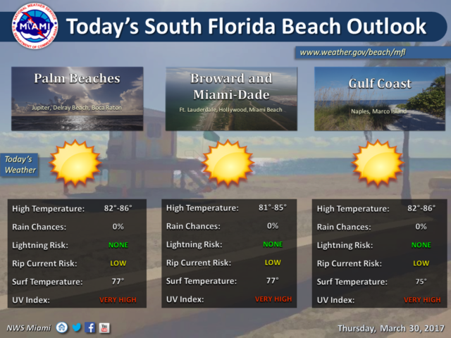
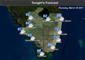
warm againSouth Florida will be warm again on Thursday as our stretch of dry weather comes to an end. After a mild morning, Thursday features good sun and a few clouds in the morning, followed by building clouds on a southeast breeze in the afternoon. Highs on Thursday will be in the mid 80s.

Friday will see a front move in, but that front is rapidly losing its punch even before it enters Florida. That means Friday will start with a mix of sun and clouds, with more clouds and a few showers moving in during the afternoon and evening. Highs on Friday will be in the mid 80s.

A few showers will linger as the front washes out and the breeze shifts to the south on Saturday. Then the day features a mix of sun and clouds with some isolated showers (and maybe a stray storm) during a hot afternoon. Saturday’s highs will be in the unseasonable upper 80s.

Summerlike weather continues on Sunday, with sun, clouds, and a few showers in the mix. Sunday’s highs will be in the upper 80s again.

Monday will see a slight cool down on a day with good sun and a few clouds. Look for highs in the low to mid 80s on Monday.

Donna Thomas has studied hurricanes for two decades. She holds a PhD in history when her experience with Hurricane Andrew ultimately led her to earn a degree in broadcast meteorology from Mississippi State University. Donna spent 15 years at WFOR-TV (CBS4 in Miami-Fort Lauderdale), where she worked as a weather producer with hurricane experts Bryan Norcross and David Bernard. She also produced hurricane specials and weather-related features and news coverage, as well as serving as pool TV producer at the National Hurricane Center during the 2004 and 2005 seasons. Donna also served as a researcher on NOAA's Atlantic Hurricane Database Reanalysis Project. Donna specializes in Florida's hurricane history.