Home Weather Typical Summer Day, Beware Of Rip Currents

Typical Summer Day, Beware Of Rip Currents

Typical Summer

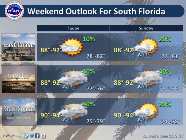
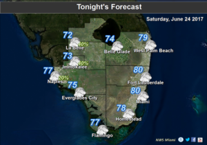
Typical SummerIt feels like a typical summer day in South Florida on Saturday, but without the afternoon storms. Instead, Saturday will feature plenty of hot sun, some clouds on the breeze, a moderate risk of dangerous rip currents at the Atlantic beaches, and just the chance of a few quick showers. Any storms will develop well inland and mostly to our north. Saturday’s highs will be in the low 90s.

Sunday will bring lots of sun, some clouds, and a few scattered showers. Highs on Sunday will be in the low 90s.

Moisture will start to work in on Monday, so a few more showers and a stray storm are in the forecast, along with sun and clouds. Highs on Monday will be near 90 degrees.

Look for a mix of sun and clouds, passing showers, and a few afternoon storms on Tuesday. Tuesday’s highs will be in the upper 80s.

More of the same is on tap for Wednesday — a mix of sun and clouds with showers and a few storms thrown in. Wednesday’s highs will be in the upper 80s.

What’s left of Cindy is bringing heavy rain to the mid-Atlantic states. Elsewhere, the tropics are quiet.

Donna Thomas has studied hurricanes for two decades. She holds a PhD in history when her experience with Hurricane Andrew ultimately led her to earn a degree in broadcast meteorology from Mississippi State University. Donna spent 15 years at WFOR-TV (CBS4 in Miami-Fort Lauderdale), where she worked as a weather producer with hurricane experts Bryan Norcross and David Bernard. She also produced hurricane specials and weather-related features and news coverage, as well as serving as pool TV producer at the National Hurricane Center during the 2004 and 2005 seasons. Donna also served as a researcher on NOAA's Atlantic Hurricane Database Reanalysis Project. Donna specializes in Florida's hurricane history.