


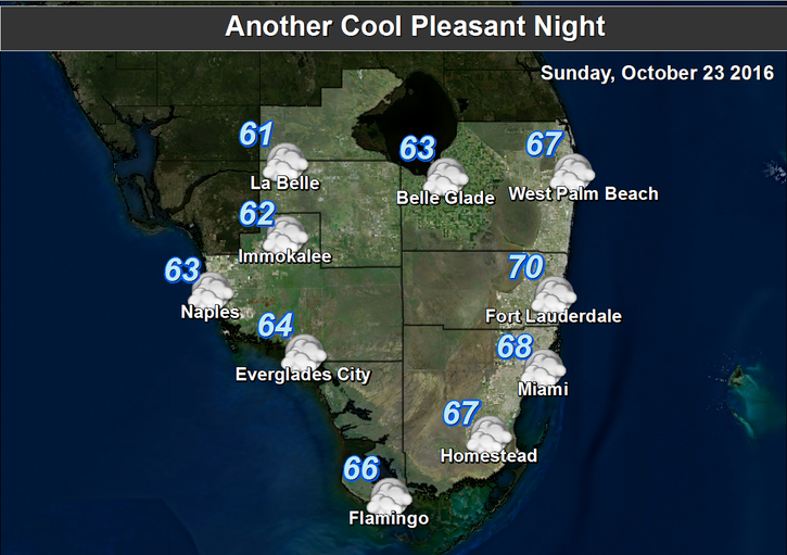
 South Florida will see pleasant fall weather on Sunday. Look for lots of sun, a few clouds on the breeze this afternoon along the east coast, a moderate risk of dangerous rip currents at the Atlantic beaches, and highs in the low 80s around South Florida.
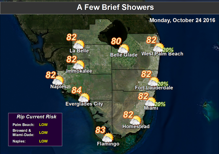 Monday will continue our touch of fall, with morning lows in the 60s (with slightly warmer lows in the Keys and a few cooler readings well inland), plenty of sun, clouds on a building ocean breeze (while the Gulf coast remains mostly sunny), and highs in the low 80s. The risk of dangerous rip currents will increase on Monday and remain elevated at least through midweek.
Tuesday will be breezy, with sun and clouds and maybe a quick shower. Look for a high risk of rip currents at the Atlantic beaches. Tuesday’s highs will be in the low 80s in most of South Florida and the mid 80s along the Gulf coast.
A few more showers are in the forecast on Wednesday in Miami-Dade and Broward, along with an ocean breeze, sun and clouds, and highs in the mid 80s. Naples and Marco Island might see a passing shower or two on Wednesday.
Another front will approach on Thursday, so look for scattered showers, periods of sun, and highs in the mid 80s.
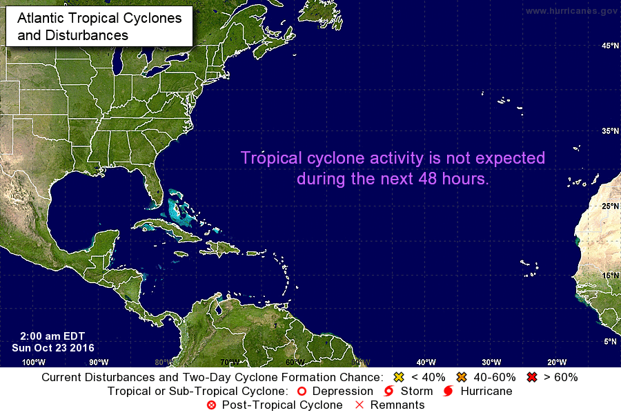
For the first time in a while, the tropics are quiet. But we’ll watch them, because hurricane season isn’t over yet.


")


