


South Florida will see some very stormy weather, starting Sunday night and lasting into Wednesday at least, thanks to the disturbance we’ve been tracking for the last few days.  The Keys are seeing some early showers on Sunday, and passing showers and storms will develop during the late morning and afternoon throughout the area. Sunday’s highs will be near 90 degrees. Our weather will deteriorate Sunday night, with passing storms, periods of heavy rain, and the threat of an isolated tornado, with especially hazardous conditions in southwest Florida. The disturbance could become a tropical depression later on Sunday.
Whether or not it develops, Monday and Tuesday will be see periods of heavy rain, localized flooding, wind gusts up to 50 miles per hour, the threat of an isolated tornado, and highs in the mid 80s.
Showers and storms will linger on Wednesday as the disturbance moves away from Florida, and the threat of localized flooding remains. Wednesday’s highs will be in the upper 80s.
The rest of the workweek will see showers and storms slowly diminish, but saturated ground will mean that the possibility of localized flooding will remain. Highs on Thursday and Friday will be near 90 degrees.
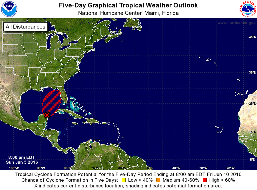 Our big concern in the tropics is the disturbance that is now near the Yucatan. The National Hurricane Center gives it a high chance of becoming a depression as it enters the southeastern Gulf of Mexico and moves toward eventual landfall somewhere between the Tampa area and the Big Bend. Elsewhere in the tropics, Bonnie is now a remnant low moving out to sea and eventual dissipation.


